1pm Update- The National Hurricane Center has been watching an area of disturbed weather of the east coast, and at 1pm they still have potential development for this system at 0% in the next 2 days, and 20% for the next 7 days, which does not change from the last projection.
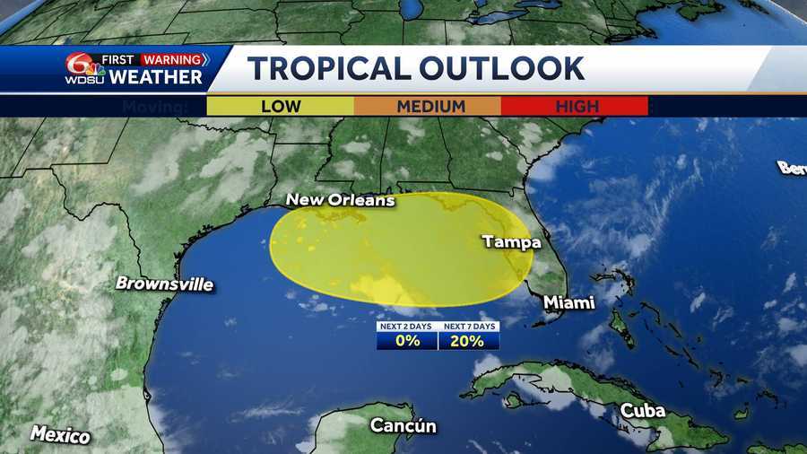
An area of low pressure is likely to form near the southeastern U.S. coast within the next couple of days and move westward across Florida and into the northeastern Gulf by Tuesday.
While conditions are not ideal for tropical development, some gradual organization is possible through the middle to late part of next week. Even if the system does not strengthen into a tropical cyclone, it could still bring rounds of heavy rainfall to parts of the eastern and north-central Gulf Coast, including Southeast Louisiana.
Forecast models suggest moisture from this system could fuel periods of downpours mid to late next week, increasing the risk for localized flooding in vulnerable areas.
WHAT WE KNOW:
Chance of development over the next 2 days: Low 0%
Chance of development over the next 3-7 days: Low 20%
IMPACTS TO SOUTHEAST LOUISIANA:
Louisiana could see heavy rainfall through next week due to the tropical development.
Stay with the WDSU First Warning Weather team for all of your latest tropical updates.
READ MORE:Low-Pressure System Could Bring Rain to Gulf Coast Next Week


