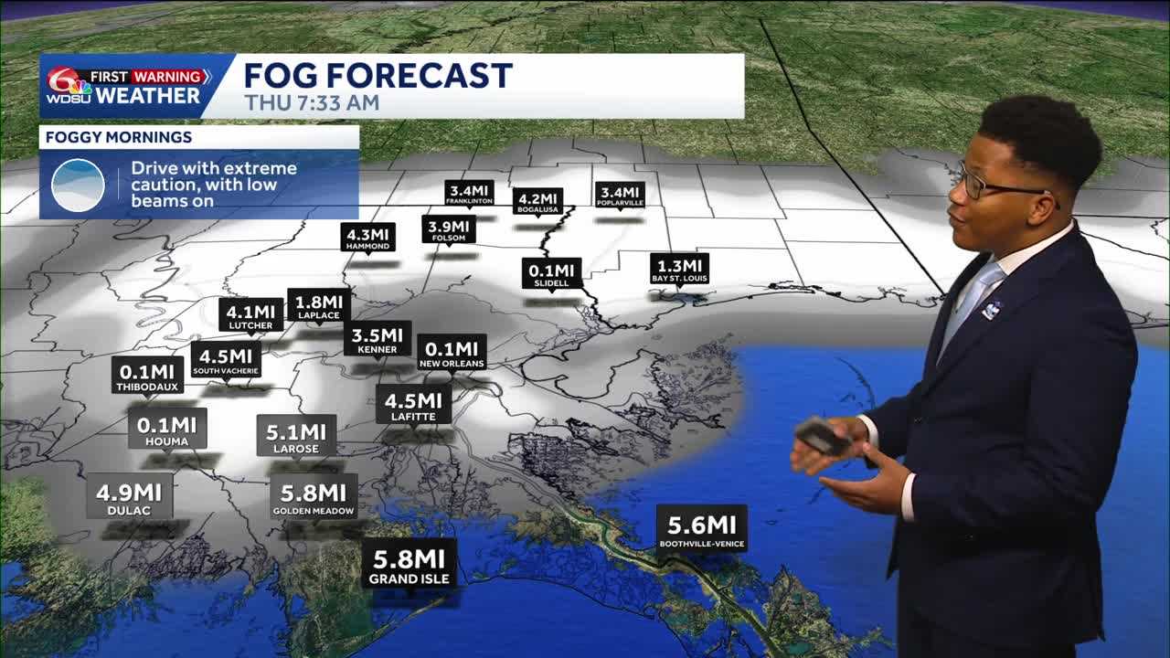
Motorists across southeast Louisiana should prepare for hazardous morning commutes over the coming days as a thick blanket of fog settles across the region, followed by a much-anticipated weekend cool down.
Thursday and Friday morning are both WDSU First Warning Weather Impact Days due to the dangerous fog across Southeast Louisiana.
Visibility has dropped to as low as a tenth of a mile in several spots during morning hours, prompting warnings for drivers to slow down and use low beams.
The Science Behind the Fog
The persistent thick fog is driven by a distinct temperature contrast. Lake Pontchartrain remains significantly warm, creating a thermal contrast as warm air moves over the cooler land and shallower water bodies.
This setup is compounded by dry air in the mid-levels of the atmosphere, layered with warm air beneath and cooler air near the surface, creating an ideal recipe for dense fog formation.
Record Heat Precedes a Weekend Cold Front
The foggy mornings coincide with unusually hot and dry conditions. Recently, temperatures tied a decades-old record, matching an 89-degree high originally set at the airport in 1963.
However, relief is on the horizon. A Canadian high-pressure system is expected to push a cold front through the area by the weekend, dropping temperatures significantly.
Overnight lows will dip into the low 50s across the Northshore and 60s in southern areas, bringing comfortable fall weather just in time for weekend events like the Wooden Boat Festival in Madisonville. Highs are expected to rebound comfortably into the 70s and low 80s under sunny skies.
READ MORE:Foggy mornings, warm afternoons and a weekend cooldown