HOT & HUMID WEDNESDAY
Wednesday will feel warm and humid, with highs near 90 degrees and a heat index near 100.
An isolated storm can’t be ruled out along the Gulf Coast, but most of Southeast Louisiana and Southern Mississippi will stay dry through Wednesday.
TROPICAL DOWNPOURS RETURN THURSDAY
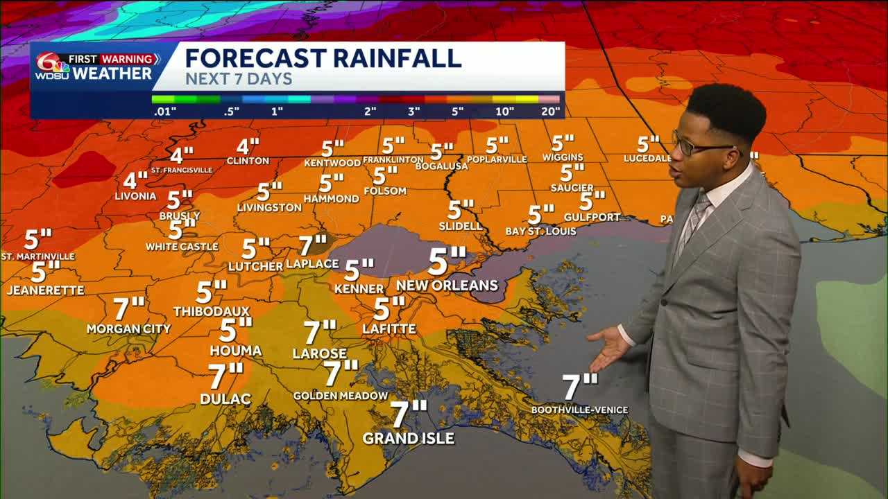
Two plumes of moisture will lead to heavy rainfall accumulation starting Thursday and lasting through Monday. A cold front, moisture charged with the remnants of Hurricane Polo, will sweep across Texas and Arkansas, pushing moisture toward Louisiana and Mississippi.
As the front pushes closer, a tropical wave from the Gulf tries to lift northward into the Gulf Coast. The moisture plumes converge over Louisiana through the weekend, with the highest rain chances Saturday and Sunday.
The Weather Prediction Center forecasts five to seven inches of average rainfall between Thursday and Tuesday across the Gulf Coast.
The Weather Prediction Center outlines several flood outlooks through the weekend including a marginal (level 1 of 4) risk for Friday, a slight (level 2 of 4) risk for Saturday and a slight risk for Sunday.
Severe weather is not expected with these heavy downpours.
DRIER AIR RETURNS AFTER THE FRONT
The front seems to win the battle against the tropical wave, pushing a real cold front to the Deep South.
Drier air returns as early as Tuesday, with the coolest morning next week falling on Thursday, with lows across Southeast Louisiana and Mississippi in the mid-60s.
READ MORE:Louisiana Weather Forecast: Increasing flood threat this weekend as tropical downpours develop