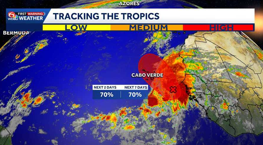
The National Hurricane Center is tracking Tropical Storm Fay and watching another system near Cabo Verde Islands off the west coast of Africa. Neither poses a threat to Louisiana.
Tropical Storm Fay
Fay became a tropical storm again Wednesday night.
Fay has winds of 50 mph and about 1020 miles west-southwest of the Azores, moving west at 6 mph.
Fay could gain a little strength over the next day before slowly weakening. It should keep moving west and slow down.
Far Eastern Tropical Atlantic – Invest 90L:
An elongated area of low pressure located a few hundred miles south-southeast of the Cabo Verde Islands is producing a large area of disorganized showers and thunderstorms. This system could become a short-lived tropical depression or tropical storm later today or on Friday while it moves northwestward to northward.
Increasing upper-level winds, however, should prevent further development over the weekend. Interests in the Cabo Verde Islands should monitor the progress of this system as gusty winds, areas of heavy rain, and flash flooding are possible over the islands by Friday. Heavy rain and flash flooding could also occur well to the east along the coast of western Africa, particularly in western portions of Senegal, The Gambia, Guinea-Bissau, and southwest portions of Mauritania.
90L Development Chances:
- Over the next 1-2 days: High, 70%.
- Over the next 3-7 days: High, 70%.
READ MORE:NHC raises development odds near Cabo Verde to 70%; Fay remains a tropical storm