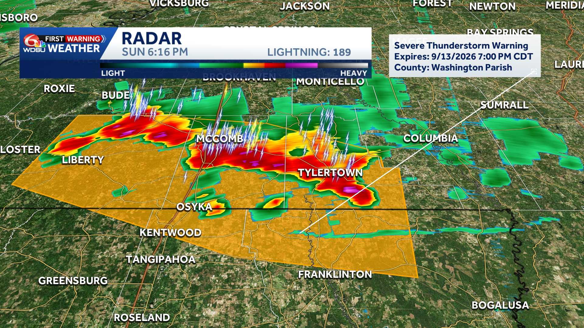
The National Weather Service office in New Orleans has issued a Severe Thunderstorm Warning covering portions of southeastern Louisiana and southern Mississippi. The alert remains active until 7:45 PM CDT.
Radar imagery identified a line of severe thunderstorms moving south at 20 mph. The storm line extends near Franklinton, Kentwood, and Liberty.
Warning Details & Hazards
- Expiration Time: 7:45 PM CDT
- Primary Hazards: 60 mph wind gusts and nickel-sized hail
- Source: National Weather Service radar detection
- Potential Impact: Gusty winds and hail may damage roofs, exterior siding, and trees across the affected region.
Affected Locations & Travel Corridors
The severe weather line is impacting several communities across state lines, as well as key interstate routes:
- Louisiana Parishes: St. Helena, Northern Tangipahoa, and Western Washington
- Mississippi Counties: Eastern Amite and Southwestern Pike
- Impacted Communities: Liberty, Greensburg, Amite, Amite City, Kentwood, Roseland, Osyka, Darlington, Mount Herman, Wilmer, Gillsburg, Easleyville, and Tangipahoa
- Interstate Corridors:
- Interstate 55 in Louisiana: Between mile markers 47 and 66
- Interstate 55 in Mississippi: Between mile markers 1 and 9
Safety & Precautionary Instructions
Residents in the warning area should take immediate safety precautions:
- Seek Shelter Immediately: Move to an interior room on the lowest floor of a sturdy building, staying away from windows.
- Flash Flooding Risk: Torrential rainfall accompanying these storms can trigger rapid urban and low-lying flooding.
- Turn Around, Don’t Drown: Never attempt to drive through flooded roads or water-covered bridges. Hydroplaning or submerged roadways present severe life-safety risks.
READ MORE:Severe Thunderstorm Warning for Tangipahoa Parish until 7:45 PM





