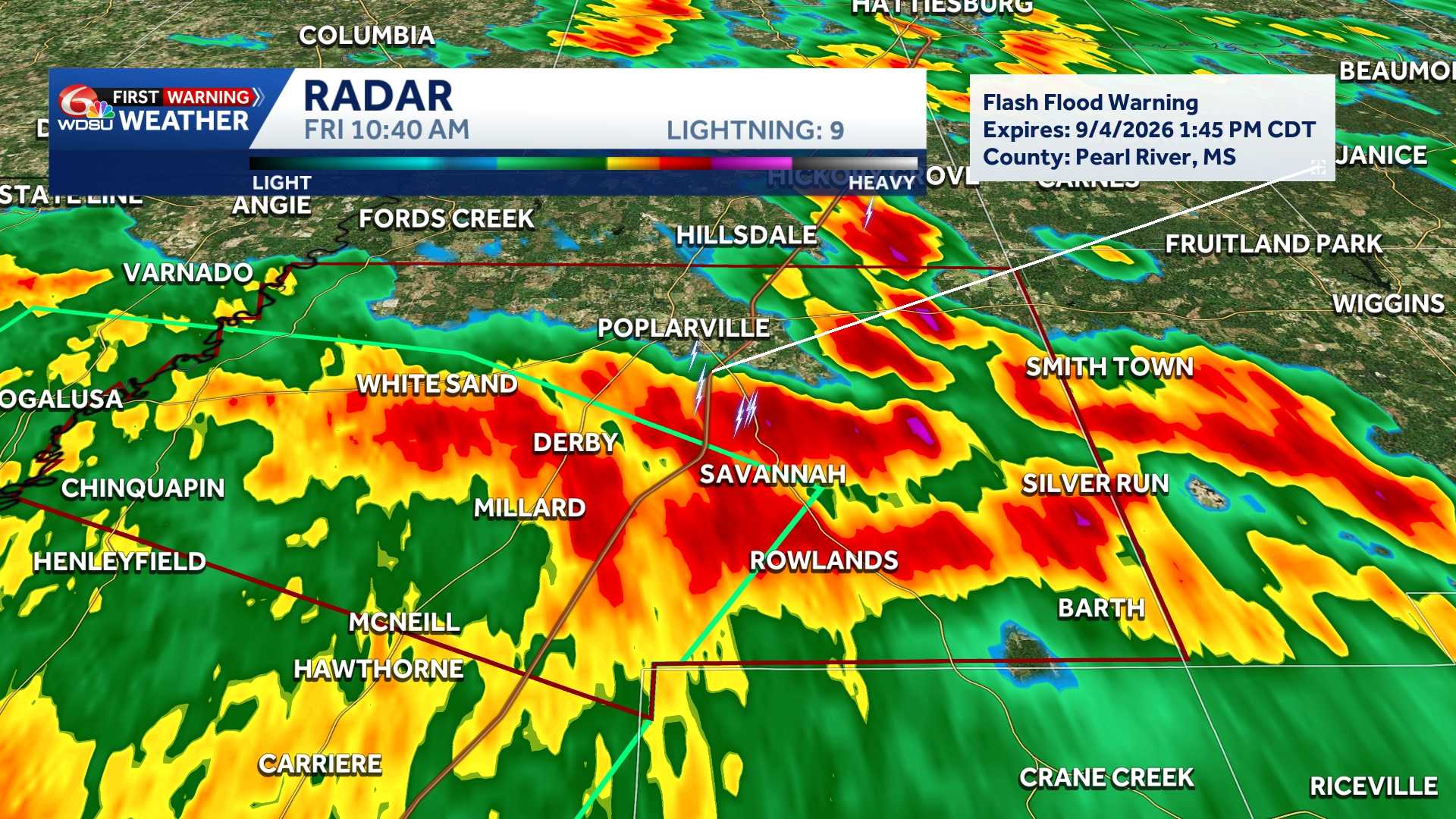
FLASH FLOOD WARNING: PEARL RIVER
The National Weather Service in New Orleans has issued a flash flood warning for central Pearl River County in southern Mississippi, effective until 1:45 p.m. CDT today.
At 10:39 a.m. CDT, Doppler radar detected heavy thunderstorms across the region, dropping between 2 and 4.5 inches of rain. Meteorologists warn that an additional 1 to 3 inches of rainfall could fall before the storms pass.
Flash flooding is ongoing or expected to begin shortly in low-lying and poor-drainage areas. Locations likely to experience flooding include Poplarville, McNeil, and Crossroads.
Hazardous conditions are expected to impact small creeks, streams, urban streets, highways, and underpasses.
The National Weather Service advise drivers to avoid flooded roadways, reminding the public to “turn around, don’t drown,” as the majority of flood-related fatalities involve vehicles.
FLOOD ADVISORY: ST. TAMMANY, WASHINGTON, PEARL RIVER
Heavy thunderstorms moving across southeastern Louisiana and southern Mississippi on Friday morning have prompted a flood advisory for portions of St. Tammany and Washington parishes, as well as southwestern Pearl River County, according to the National Weather Service.
The advisory remains in effect until 12:45 p.m. CDT.
Radar indicated between 1 and 3 inches of rain had already fallen across the area by 9:43 a.m. CDT, with an additional 1 to 2 inches expected before the storms pass. Forecasters warned that the additional rainfall will lead to minor flooding in low-lying and poor drainage areas.
Communities expected to experience flooding include Bogalusa, Sun, and Bush in Louisiana, along with Picayune, McNeil, and Crossroads in Mississippi.
READ MORE:A Flash flood warning stretches across Pearl River county, Mississippi until 1:45 pm





