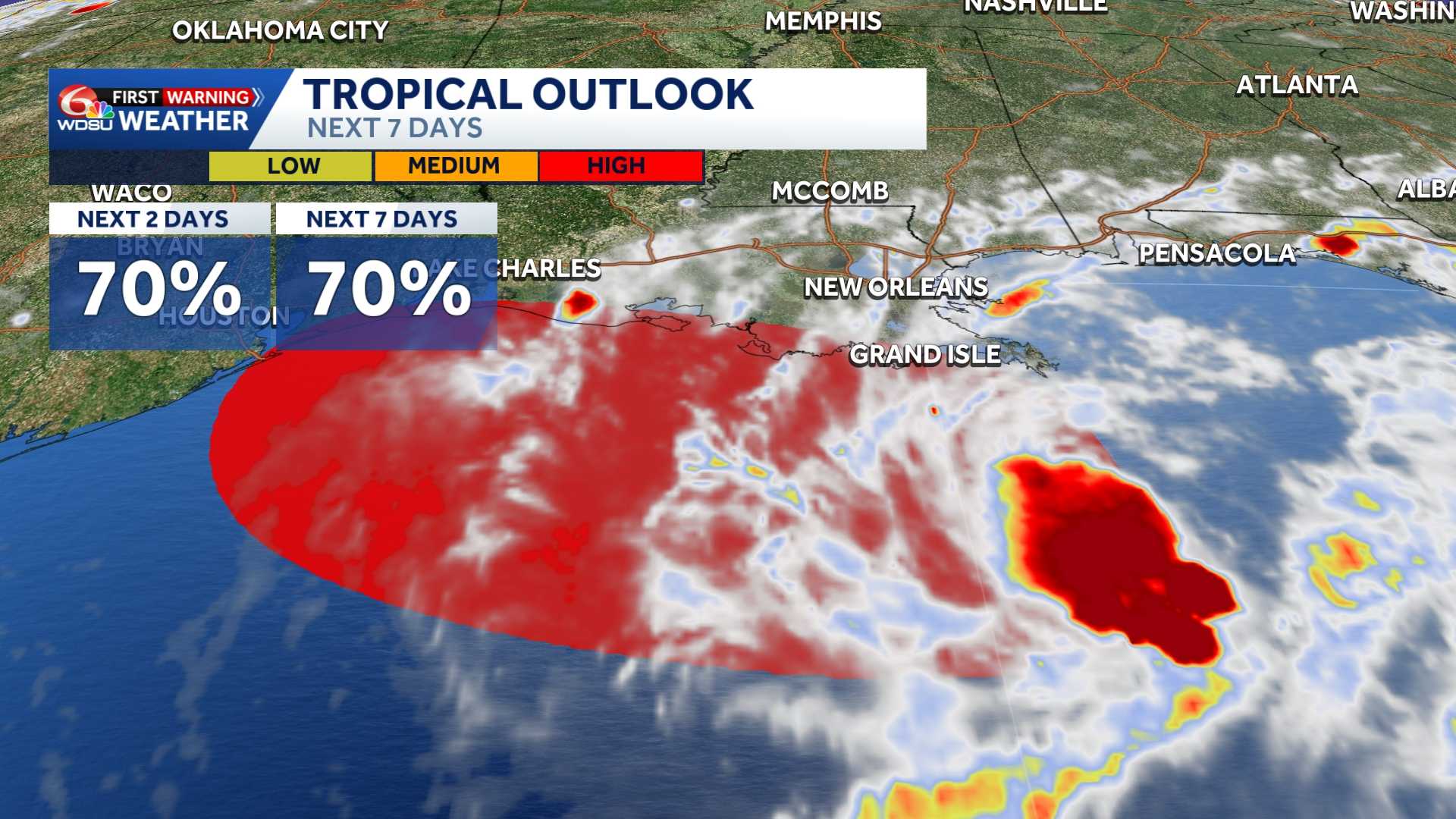
A low-pressure system in the northern Gulf could briefly become a tropical depression or tropical storm before reaching the Texas or Louisiana coast.
The system, designated AL97, was about 125 miles south of southeastern Louisiana as of 2 p.m. EDT, according to the National Hurricane Center. Satellite imagery and wind data showed the disturbance had become better organized since Saturday.
The low is expected to move slowly west-northwest toward the upper Texas or southwestern Louisiana coast, where it could arrive Tuesday or Tuesday night.
The National Hurricane Center gave the system a 70% chance of developing within 48 hours and of whether it develops, the system could produce locally heavy rainfall in coastal sections of southwestern Louisiana and upper Texas during the next several days.
Meanwhile, the remnants of Tropical Storm Dolly were producing showers and thunderstorms from Puerto Rico eastward across the Virgin Islands and northern Leeward Islands.
Satellite data and surface observations showed no signs of a closed surface circulation. Redevelopment was considered unlikely through Tuesday as the tropical wave moved west to west-northwest at about 25 mph.
The system could bring locally heavy rain and gusty winds to the Leeward Islands, Virgin Islands, Puerto Rico and Hispaniola over the next few days.
Conditions could become more favorable for redevelopment by the middle of the week, when the system is expected to reach the southeastern Gulf. The hurricane center gave it a near-zero chance of development within 48 hours and a 20% chance over seven days.
READ MORE:Gulf Watch: Tropical Storm Edouard could form to start the week, impacting Louisiana and Texas





