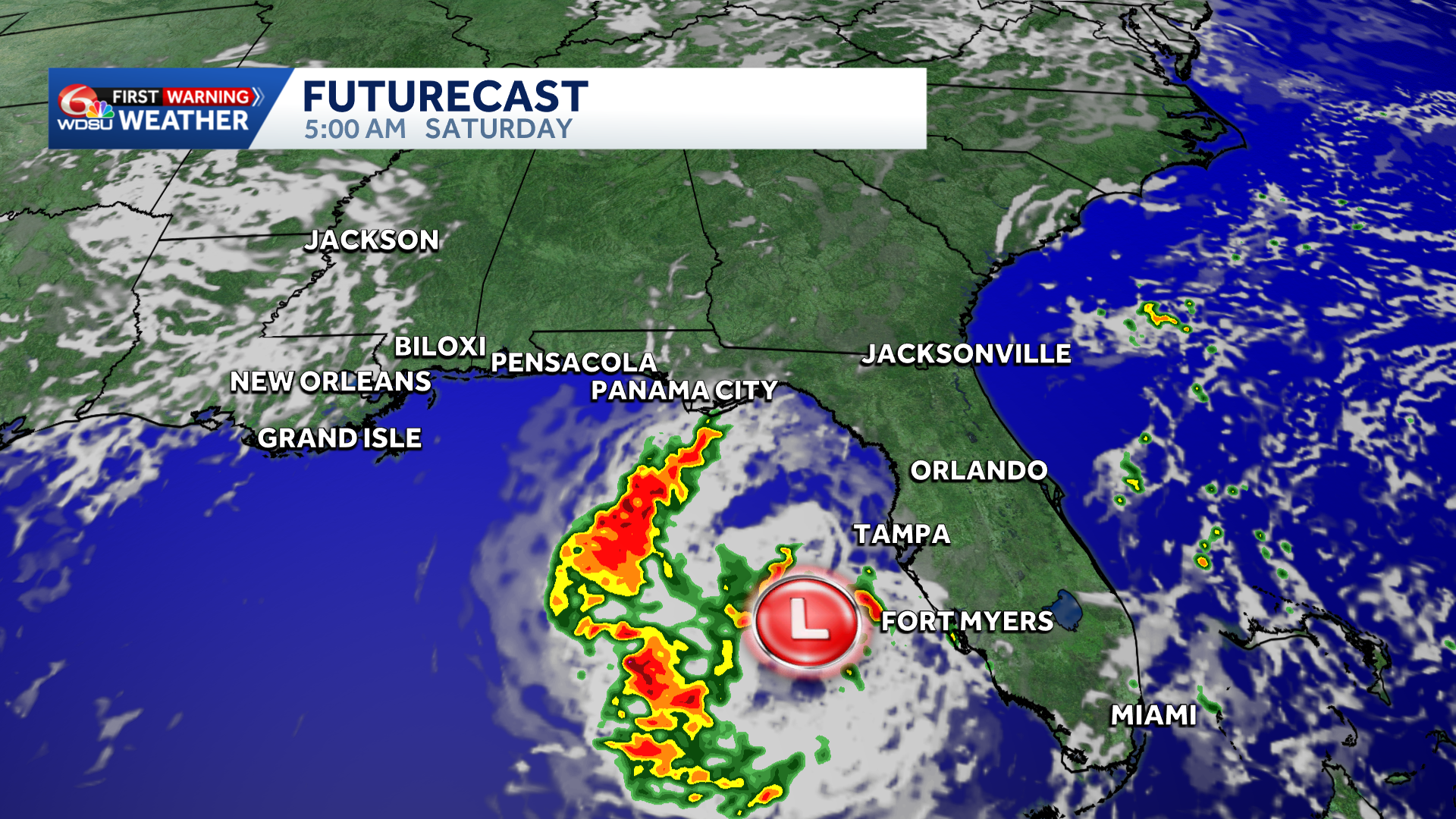
A rainy forecast is in store for parts of Florida this weekend as a weak area of low pressure forms in the northeast Gulf.
Localized heavy rain and flash flooding possible in north/central Florida from Panama City to Tampa/St Pete.
There is still a low chance for tropical development according to the National Hurricane Center. Northerly wind shear and land interaction will hinder development.
Given the only marginal environmental conditions, it’s possible that a tropical depression or Tropical Storm Bertha could form into early next week. The main concern will be localized heavy rain, especially in Florida.
What I’m watching? Whether it develops or not, this disturbance may drift west by early to mid next week. The Google Deep Mind Models, European Ensemble Models, and Euro AI Models have shown an uptick in a more westerly solution.
Enhanced tropical moisture and increased rain chances possible along the central Gulf Coast by the middle part of next week. Something to monitor.
READ MORE:Rainy forecast along the beach as a tropical disturbance forms this weekend in the Gulf





