Today is a WDSU First Warning Weather Impact Day as dangerous heat returns and strong-to-severe thunderstorms develop through the afternoon and evening.
A heat advisory stretches across southeast Louisiana and southwest Mississippi through 6 p.m. as highs climb to the mid-90s and heat indices between 105-110 degrees.
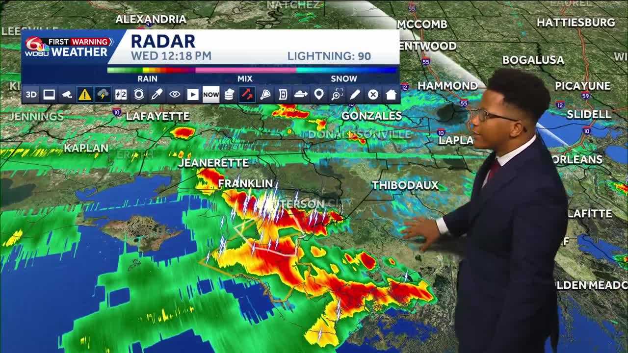
While the ongoing storms will last through 9 p.m. across the south shore, the north shore likely won’t see any development until 5 p.m.
Any storms that do arrive do have the potential to be strong to severe. The main impacts would be strong winds, heavy downpours, and a lot of lightning. Waterspouts can’t be ruled out.
Starting Thursday, we enter our typical summertime pattern again. Highs tomorrow into the weekend will be in the low 90s, feeling like the triple digits. We’ll see daily afternoon scattered rain chances, but washouts are not expected.
4th of July forecast looks hot with highs in the 90s with a few scattered storms possible.
READ MORE:Impact Day: Severe storms possible with triple-digit heat in Louisiana’s weather forecast


