Everyone say “thank you wind shear!” It’s the fourth day of hurricane season, and at first glance, the Gulf looks quite turbulent.
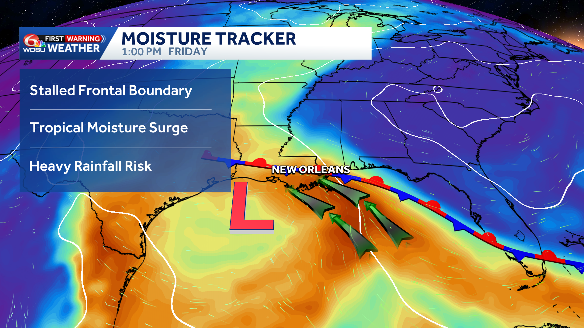
Fortunately, even though it looks quite impressive on satellite, this broad area of low pressure in the Gulf is unlikely to develop into a tropical depression or tropical storm due to high wind shear and nearby dry air.
However, the surge of tropical moisture along with gusty winds will cause impacts along the Gulf Coast into the weekend.
After a breezy and briefly drier day Thursday, rain chances in south Louisiana will increase Friday-Saturday. Localized heavy rain possible with hot spots of 3+ inches possible. Watch for isolated flash flood concerns.
In addition, minor coastal flooding in SE Louisiana and S Mississippi into Friday. Tides 1-2 feet above normal.
A big heads up for those traveling to the Florida and Alabama Beaches late week/weekend. Double red flags are flying due to a high rip current risk and very rough surf. Stay tuned!
READ MORE:Gulf Blob Increases Rain Chances, Coastal Flood Risk Late Week


