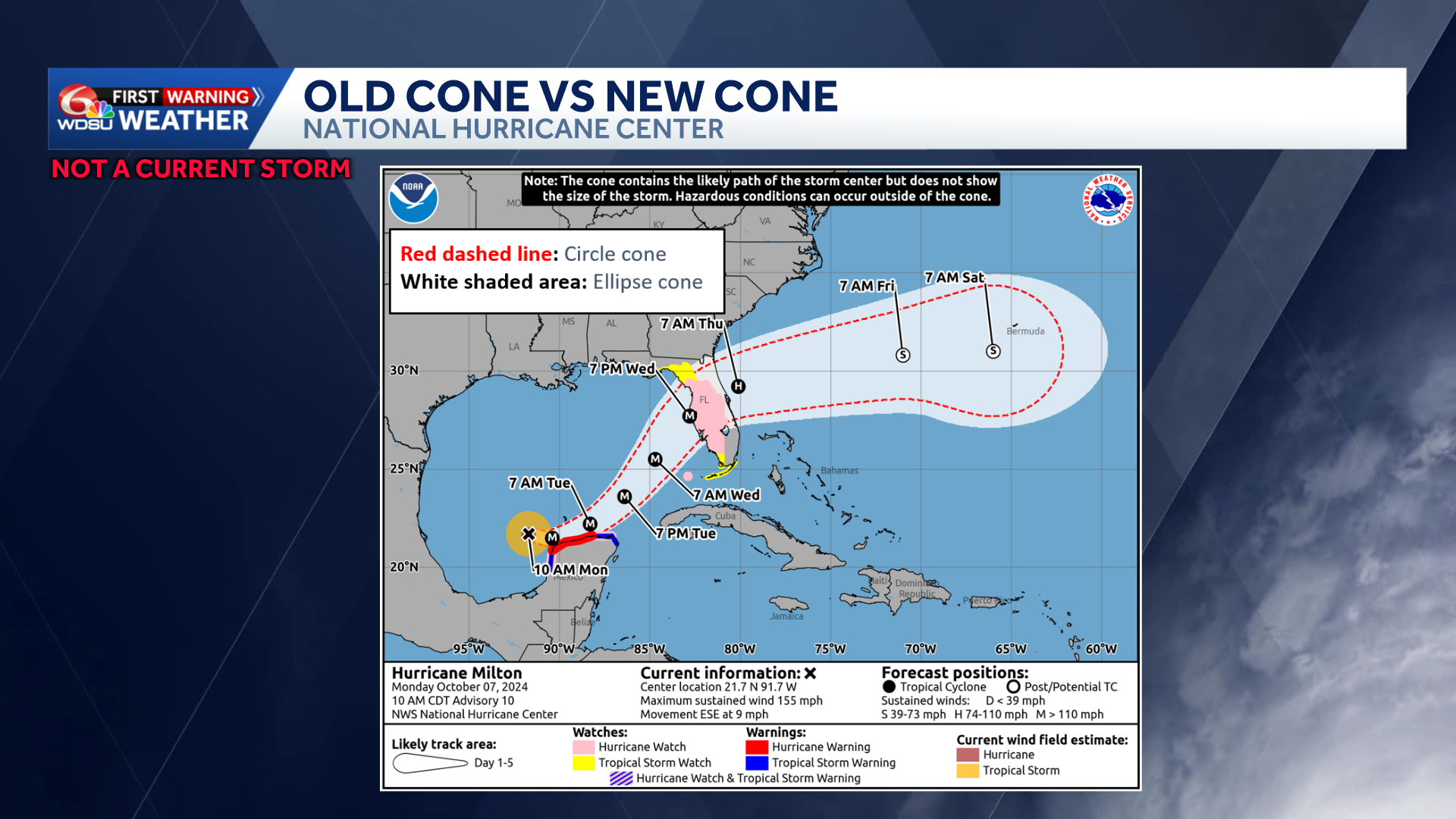
The National Hurricane Center is updating its hurricane forecast cone this season for the first time since 2002. They are increasing its size and improving its accuracy to better reflect potential storm paths and risks.
The cone, which represents the percentage of time a storm’s center is expected to stay within its boundaries, will now capture 90% of possible tracks, up from 67% over the past 20 years.
The updated cone will be 23% larger than in previous seasons. The circles that previously defined the cone are being replaced by ellipses, which capture two types of forecast errors: how far ahead or behind a storm tracks and how far left or right it drifts.
For the first time, the operational cone will display inland tropical storm and hurricane watches and warnings. Areas such as Covington, Hammond, Poplarville, and regions well north of the coast will now see their risks directly reflected on the forecast cone.
The National Hurricane Center emphasized that the cone only represents where the center of the storm is expected to go. Impacts such as waves, storm surge, rainfall, and wind can extend far beyond the cone in any direction.
READ MORE:What you need to know about changes coming to the ‘Cone of Uncertainty” this hurricane season


