Heads up into Memorial Weekend!
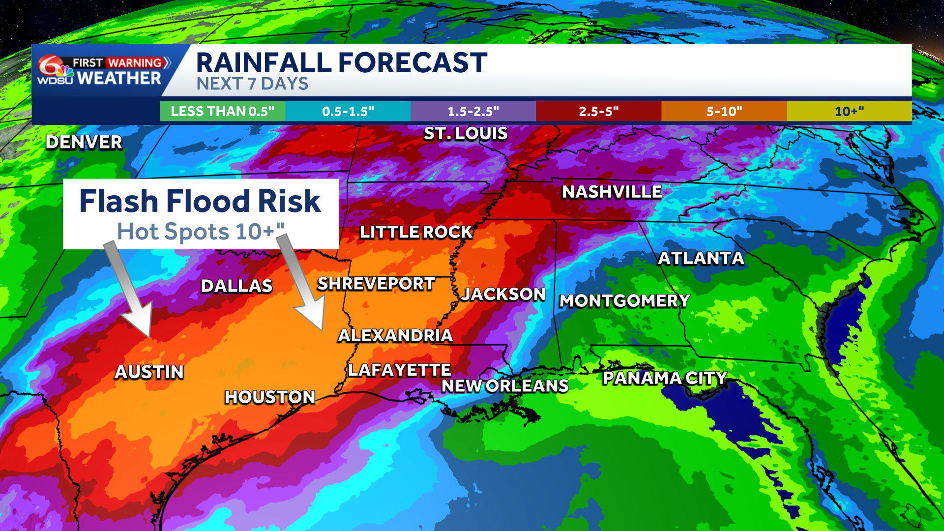
Stubborn setup stalls across the Deep South & western Gulf Coast over the next week to 10 days. Hot spots of 6-12+” of rain likely.
The rain will comes in rounds, and there will be breaks; but in areas where repeated waves of storms occur, expect flash flood concerns.
The bullseye of heaviest rain starting by Tuesday/Wednesday(5/19-5/20) will be across South-Central Texas into Western Louisiana/Arkansas.
The Weather Prediction Center mentions that heavy rain will make headlines into late week with flash flooding likely.
By late week into this upcoming weekend, several additional disturbances look to shift the axis of heaviest rain potential into western Louisiana. Stay tuned as projected timing and rain totals become more fine tuned.
Right now, manageable totals 2-4” over 7 days for the New Orleans metro and southeast Louisiana. However, those numbers could trend much higher if this axis of heavy rain shifts southeast like the last several events have this month. Stay tuned!
READ MORE:Growing flash flood threat across Texas, Louisiana


