Happy Friday! A stellar start to the weekend on the way with a cold front scheduled to arrive overnight Friday into Saturday morning.
Highs on Friday reach 82-86 degrees with partly cloudy skies. A few spots will be close to record-breaking temperatures.
A cold front moves in tonight into early Saturday morning bringing in breezy conditions and drier air.
Because of that, we are looking at a Red Flag Warning Saturday for the Northshore and Mississippi Coast as humidity is expected to be very low on top of drought conditions. Avoid outdoor burning as fires can spread rapidly.
Boating is also not recommended Saturday with a Small Craft Advisory issued for tidal lakes, the Mississippi Sound and coastal offshore waters. Waves 2-4+ feet along with 25-35mph winds will make for hazardous boating conditions.
Highs Saturday will drop to near average in the mid 70s with partly cloudy skies and breezy conditions.
For Sunday, expect highs to also be in the 70s but maybe a degree or two higher than Saturday.
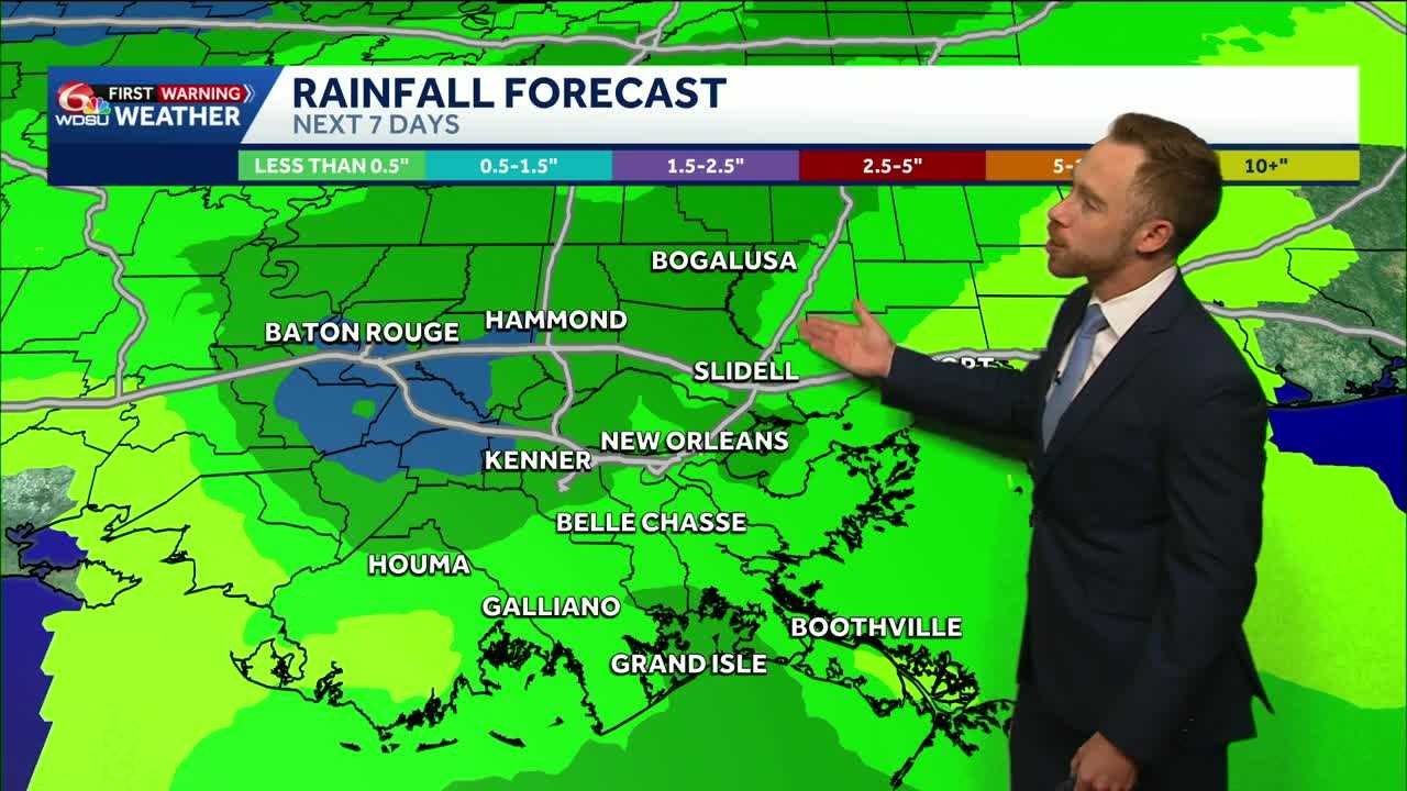
We’ll also introduce daily rain chances starting Sunday! We could really use it! A slight chance for spotty showers Sunday then about a 30-40% chance starting Monday through much of next week.
Rainfall amounts generally look light with .25-.5″ over the next week with hot spots of 1+” possible.
READ MORE:Critical fire risk and cooler Saturday, rain chances return Sunday!


