Today is a WDSU First Warning Weather Alert Day due to the threat for strong to severe storms tonight into Thursday morning.
A few scattered showers can be expected throughout the day before the main line of storms moves in tonight.
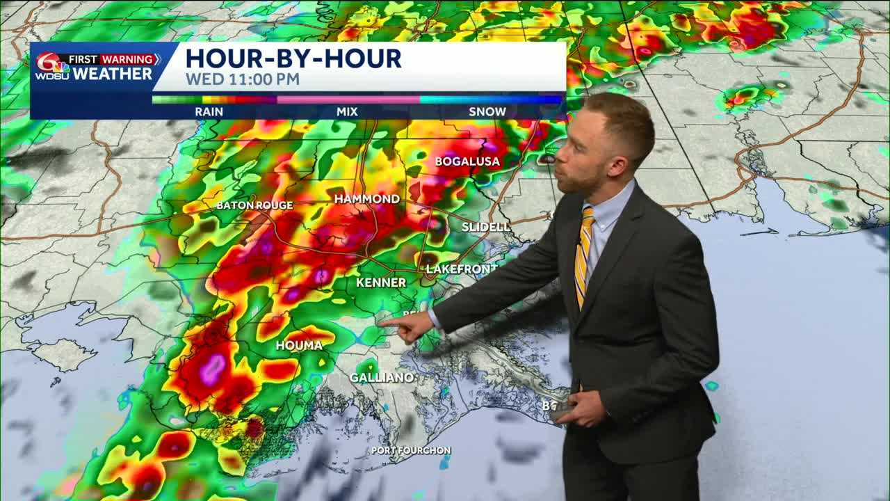
Timing:
- 9 p.m.: line of storms in the Baton Rouge area
- 10 p.m.: line enters Tangipahoa Parish to the Bayou Parishes
- Midnight: storms impacting New Orleans, more of the Northshore
- 1 a.m.: line on the other side of New Orleans, moving into Coastal Mississippi
- 2 a.m.: line of storms moves out of Southeast Louisiana
Impacts:
- Level 2 out of 5 threat for severe weather
- Damaging Winds 45-60mph
- Embedded tornado risk, isolated strong tornado possible
- Small Hail
- Heavy Rain, 1-2″
After the strong line of storms moves through, expect a few scattered showers on the backend of this system before daybreak Thursday.
Behind the rain will be much cooler air! Most of Thursday will be in the 50s and 60s.
The average temperature for this time of the year is usually 71 degrees.
Heading into Friday, highs reach the low to mid 70s. By Saturday, highs are in the mid to upper 70s. By Sunday, highs are back in the 80s!
Another cold front moves in and drops temperatures significantly at the beginning of next week.
READ MORE:Alert Day: Damaging winds, isolated tornado risk tonight


