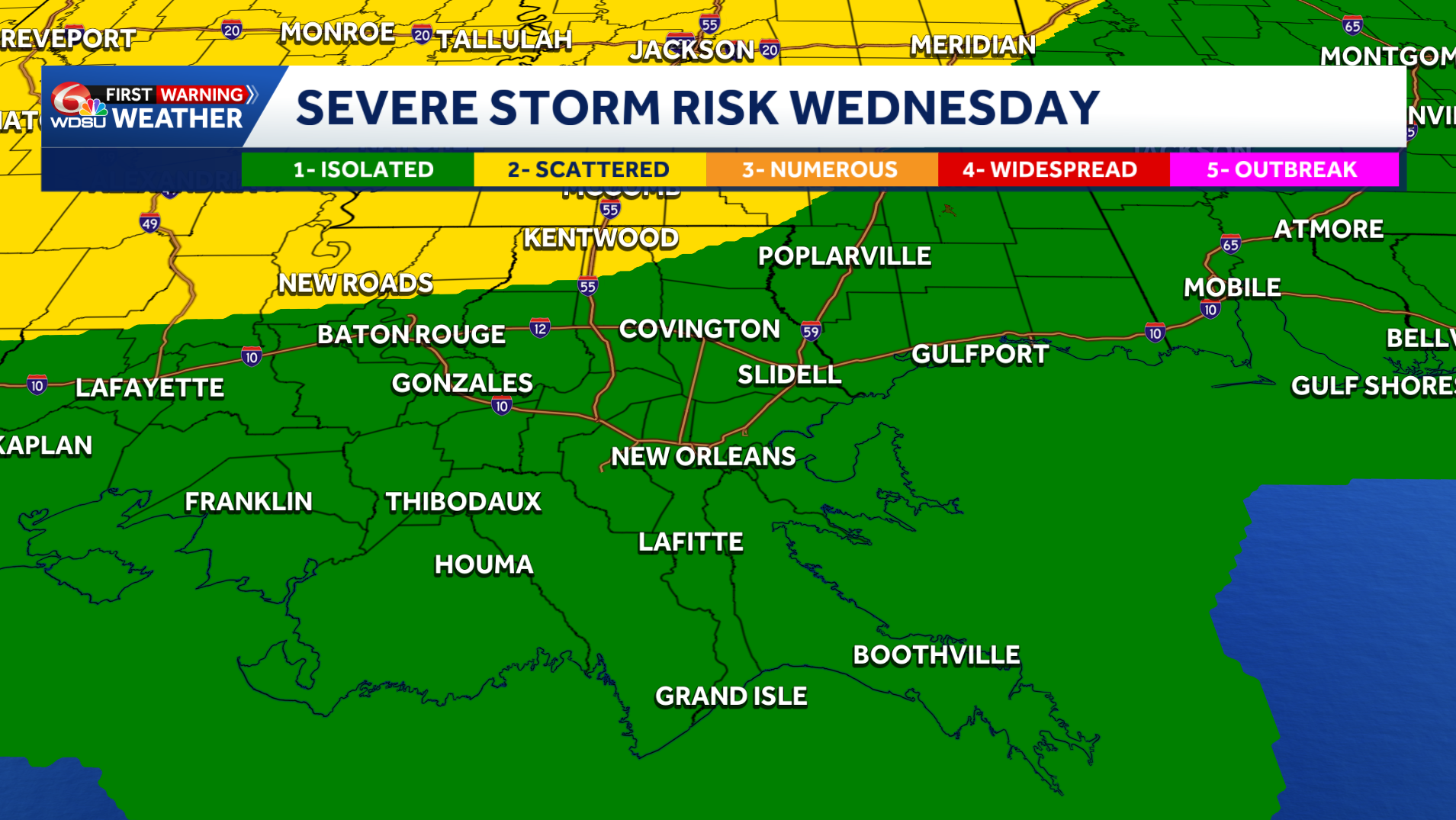
Southeast Louisiana and coastal Mississippi are under a Marginal (level 1) and a Slight (level 2) risk for severe weather Wednesday night into Thursday morning.
TIMING:
We’re still more than 48 hours away, so timing and details will become more clear as we get closer.
Right now, our in-house model shows storms moving into the Northshore after 9 p.m., reaching New Orleans by 11 p.m.
This line of storms continues moving in for the rest of the area, possibly moving out before 5 a.m. Thursday.
The European model also shows storms arriving around midnight, but moving out much later around 7 a.m.
The GFS or American Model has rain moving in around 10 p.m. with the strongest line hitting the metro around 1 a.m. and completely moving out of the area after 7 a.m.
IMPACTS:
As of now, the biggest threat appears to be strong winds. Tornadoes are also a possibility as this system moves through.
More updates to come as we get closer! Stay weather aware!
READ MORE:Severe weather threat for Southeast Louisiana late Wednesday into early Thursday


