Today is a WDSU First Warning Weather Impact Day due to a Dense Fog Advisory for everyone until 9 a.m. Visibility can be reduced to less than a mile in some spots for the morning commute.
After the fog clears, expect mostly cloudy skies with highs from 81-83 degrees.
There is a chance for a spotty shower in the afternoon, but most areas will stay dry.
Lows tonight drop to the mid to upper 60s with another chance for patchy fog to develop.
Highs Tuesday and Wednesday are both in the mid 80s, which could break records.
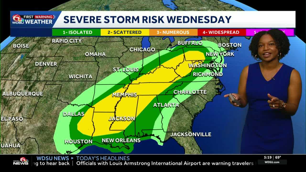
The next big change is the midweek storm system that will bring the threat for severe weather late Wednesday into Thursday.
Main impacts could be heavy rain and strong winds.
Behind that system will be much cooler air with highs Thursday in the upper 60s to low 70s!
That brief cooldown doesn’t last long. By Friday, highs rise back above average. 80s are expected at the end of the weekend.
READ MORE:Impact Day: Dense fog possible then midweek storms expected


