Heads Up! A few spotty showers today with hit/miss rain likely. WDSU First Warning Weather Impact Days for Saturday and Sunday as we track the potential for a few strong to severe storms.
It won’t be a washout this weekend…in fact, more dry hours than wet likely. But, period of rain and storms likely, especially late Saturday evening-early Sunday.
A sluggish frontal boundary will be moving south, and questions remain about when the rain/storms will arrive.
Storm Prediction Center has placed a Marginal (Level 1 out of 5) for severe storms in much of south Louisiana late Saturday-Sunday!
Main concern of gusty winds, localized heavy rain & frequent lightning.
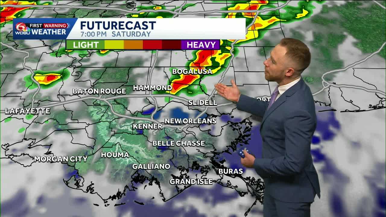
Hi-res model guidance indicates Sunday morning 5am-11am as the primary time frame, but I wouldn’t rule out some heavier storms moving in earlier for some…especially north of I-10 Saturday evening.
The timing will likely change, but there is a chance rain could move out before the St. Patrick’s Day parades in Slidell and Gretna begin
Looking ahead to next week, highs remain in the 80s. Daily rain chances will also continue. The greatest chance will arrive Wednesday into Thursday.
By Thursday, highs fall to the mid 70s.
READ MORE:Spotty showers today, higher rain chances late Saturday-Sunday


