A few thunderstorms will drift from west to east Saturday evening, but a line of potentially severe storms is expected to move through quickly overnight.
The WDSU First Warning weather team has issued a weather Impact Day for the overnight hours because of that potential for severe weather, especially on the North Shore.
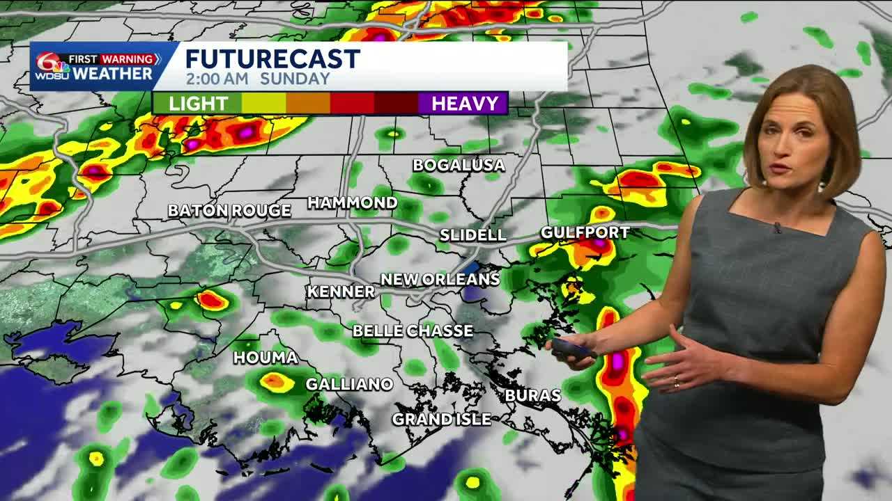
The line of storms is going to move from north to south, arriving in the North Shore parishes around 2 am. Storms will then be near New Orleans and the South Shore by 5 am. By 8 am, the storms will be clear of Southeast Louisiana.
Damaging wind gusts and torrential rain are expected as storms come through tonight. The flooding risk is minimal as storms will be moving quickly. An isolated tornado can’t be ruled out, but the threat is relatively low. Still, people should have a way to receive weather alerts through the overnight hours. Be sure your devices are charged this evening.
Once storms clear, Sunday will be sunny and gradually more comfortable. There will be a big drop in humidity in the afternoon leading to a night that will feel cool to most.
Monday morning will start with North Shore temperatures in the low 50s. The South Shore will start close to 60. The coming work week will be dry and comfortable.
READ MORE:Tracking thunderstorms overnight Saturday, early Sunday


