Brrrr! Get ready for a taste of winter!
Highs will stay in the 60s Friday through Monday, with a stretch of cold nights ahead. Saturday morning is expected to be the coldest.
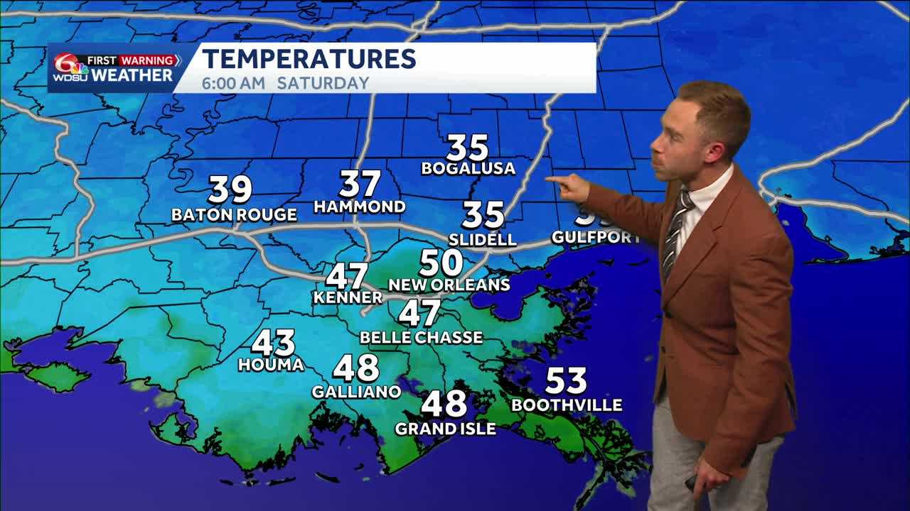
Friday morning lows will fall into the lower 40s. By Saturday morning, temperatures are expected to range from 33 to 39 degrees, with the coolest readings in far northern Tangipahoa and Washington parishes and other rural areas. Lows will reach the upper 30s again Sunday morning.
Patchy frost is possible Saturday morning, though dry soil may limit frost formation. Gardeners should consider protecting sensitive tropical plants and warm-season vegetables and herbs, including tomatoes, sweet potatoes, basil and cucumbers.
Make sure pets have a warm place to stay. There is no need to drip faucets with the temperatures currently expected.
Coastal Low Potential Sunday Night–Monday
Cloud cover will increase Sunday as we watch the potential for a coastal low to develop Sunday night into Monday morning. Model guidance remains all over the place, so there’s still considerable uncertainty about the system’s track and impacts.
A tightening pressure gradient between high pressure to the north and low pressure to the south will bring breezy conditions Sunday, with winds of 15–20 mph, becoming windier Monday at 15–30 mph. Offshore marine hazards are likely.
Monday brings the better chance for rain, but how much Louisiana sees will depend heavily on the system’s track. A more southern track would bring little rain, while a track closer to the coast or inland would increase rain chances.
Stay tuned for updates!
READ MORE:Temperatures tumbling into the weekend. Watching a potential Gulf coastal storm by Monday.