Following weekend downpours that dumped up to 17 inches of rain on localized areas of the Gulf Coast, drier conditions will offer temporary relief before a cold front brings scattered storms back to Southeast Louisiana midweek.
Heavy rainfall over the weekend hit several communities hard, with Metairie, Kenner, and Bucktown receiving between 6 and 8 inches. Northern Washington Parish saw 6 to 7 inches, while Pearl River County, Mississippi, recorded the highest totals, with 15 to 17 inches falling over a six-hour period near Crossroads. The excessive runoff triggered flood warnings for local creeks that have since crest, along with coastal flood advisories across St. Tammany, St. Bernard, and Eastern Orleans parishes driven by high perigee tides.
Midweek Outlook
Rain chances will remain low through Monday afternoon, with less than a 20% chance of showers across the local viewing area.
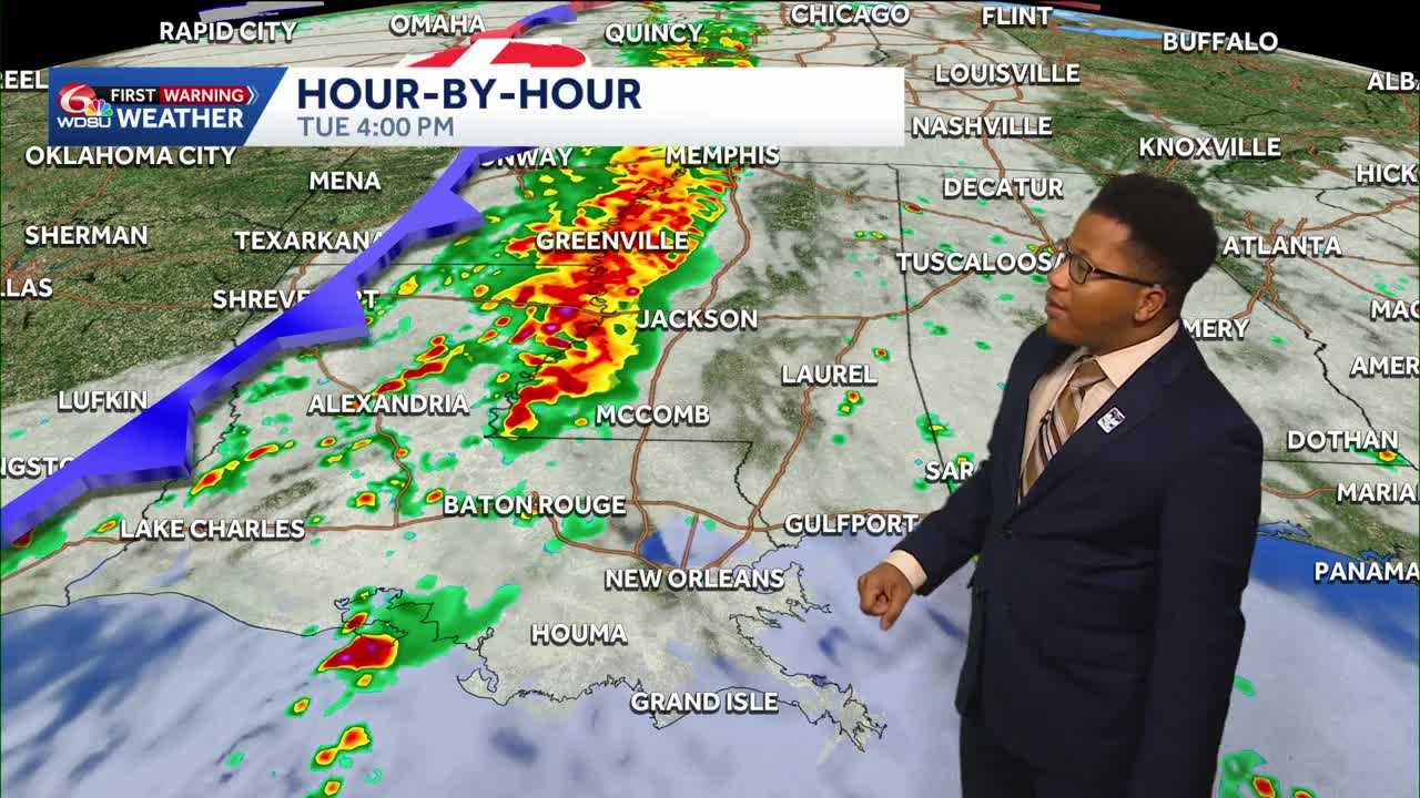
A cold front pushing east across the region is expected to bring scattered storms starting Tuesday afternoon and continuing into Wednesday:
- Severe Weather Risk: The highest potential for severe weather and flash flooding will remain concentrated to the north across northern Louisiana and western Mississippi.
- Local Impacts: Isolated downpours and brief thunder remain possible for Southeast Louisiana starting around 4 p.m. Tuesday through Wednesday afternoon. Rainfall totals are projected to stay around half an inch or less for most of the metro area.
- Voting Day Forecast: Rain chances sit at 40% for Tuesday and 50% for Wednesday. Voters heading to the polls on Election Day should prepare for spotty showers by keeping rain gear handy.
Drier and cooler air is expected to filter into the region behind the front by Wednesday night, though lingering moisture could support isolated showers through the remainder of the workweek.
READ MORE:Scattered storms return midweek, as a cold front returns to Louisiana’s weather forecast