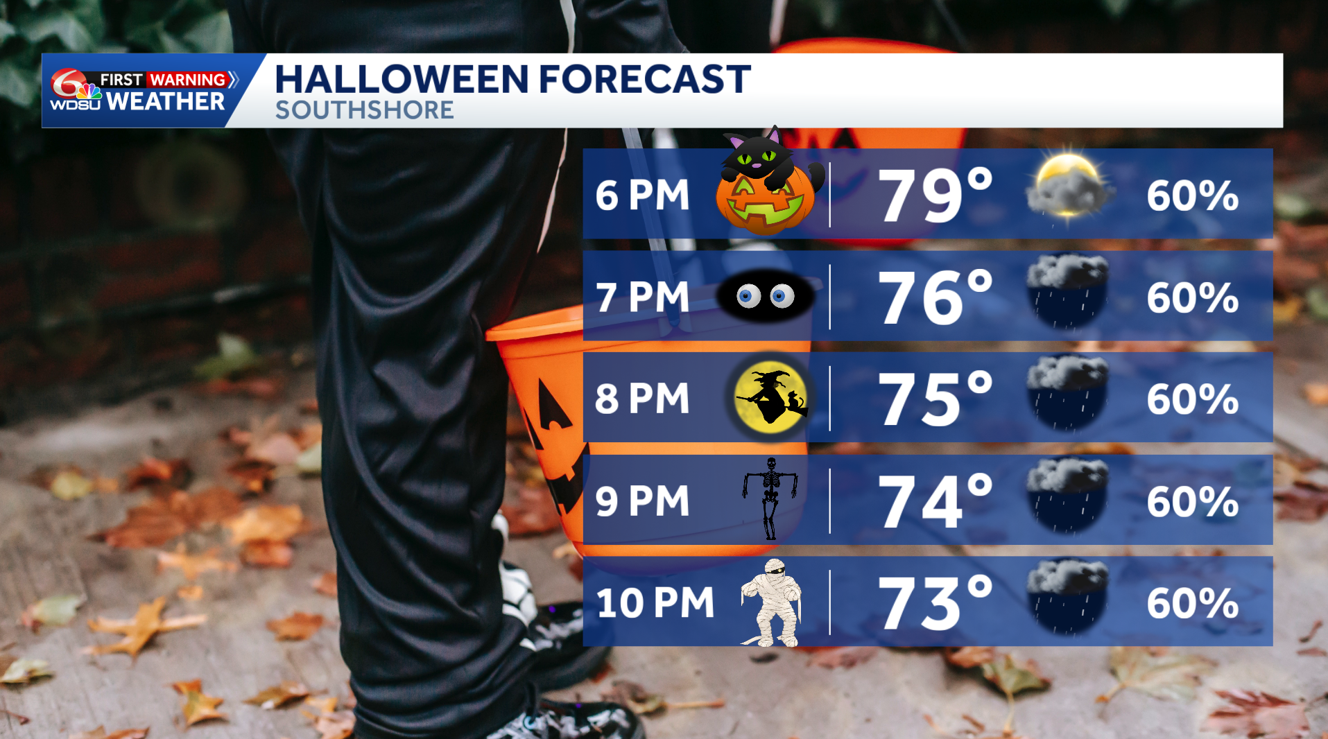
Candy bags ready? Keep an umbrella nearby, too. Scattered showers could join Halloween festivities across southeast Louisiana and southern Mississippi on Saturday.
As of Friday morning, showers and a few thunderstorms could develop by late morning or around midday. Rain chances continue into Saturday evening, which could mean interruptions for trick-or-treaters!
What about trick-or-treating?
Rain will be hit-or-miss, so some neighborhoods could have dry breaks while others see showers. We’re still watching where those showers will develop and how much they will overlap with the evening candy hunt.
Keep your plans, but have an indoor backup and check the radar before leaving home. A chance of rain does not mean it will rain all evening.
If you hear thunder, head indoors.
How warm will Halloween be?
Saturday’s highs will reach 80 to 84 degrees. Expect a warm start to evening festivities, so keep comfort in mind when choosing costumes.
Showers remain possible Saturday night, with more passing rain and a few storms Sunday. Mainly dry weather returns Monday.
Why is rain returning?
More moisture is moving into the area as a weather disturbance approaches from the west. That combination will help showers develop after our long dry stretch.
The rain is expected to be scattered, with breaks between showers rather than steady rain everywhere all day.
Are severe storms expected?
Severe storms are not expected Saturday at this point. Still, any thunderstorm can bring lightning, and passing downpours could briefly interrupt outdoor events.
What we’re watching
The biggest question is which areas will see rain during trick-or-treating hours.
We’ll keep updating the timing, coverage and chances for dry breaks as new forecast information comes in.
Check back with WDSU First Warning Weather before heading out for Halloween fun.
READ MORE:Ghosts, goblins and umbrellas? Your Halloween forecast is here