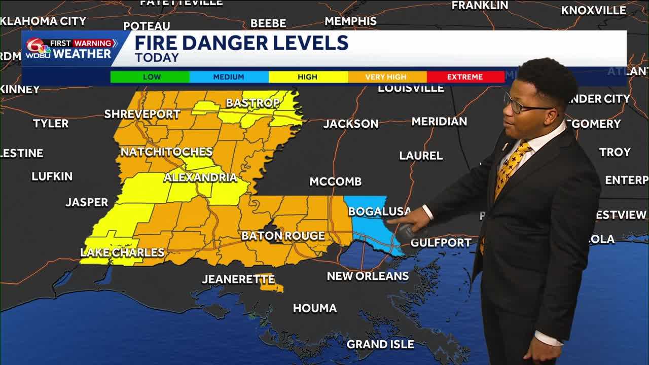
Today marks the 20th day with no rain at the New Orleans Airport, representing ongoing drought conditions across most of Louisiana. Low humidity and the lack of rain has increased fire danger levels and burn bans across the state.
Fire danger levels measure the likelihood of accidental fires and their resilience. The only parameter keeping fire danger levels at bay is the lack of strong, gusty winds. Locally, strong wind gusts can increase the fire danger risk; however, high winds are not in the forecast over the next seven days.
If you are headed out to the Krewe of Boo or any other activities this evening, it’ll feel quite pleasant!
The low humidity has felt great after a oppressively humid summer. Drier air leads to more diurnal heating, with cooler mornings and warm afternoons. Morning lows Sunday will fall to the upper 40s and mid-50s across the Northshore. It’ll feel like the upper 50s and low 60s across the Southshore.
Highs climb back to the upper 70s and low 80s Sunday afternoon, with warmer temperatures across the North Shore.
The drier weather will continue through the work week. Afternoon humidity levels will climb starting Wednesday. Isolated showers are possible on Saturday for Halloween, but we won’t know the full extent and timeline until mid-week
READ MORE:Louisiana’s weather: Drought, Halloween, and Saints in Paris Forecast