Tropical moisture filtering into the Gulf Coast will bring scattered afternoon thunderstorms and hot temperatures to southeast Louisiana throughout Labor Day weekend, though outdoor holiday plans won’t be a total wash.
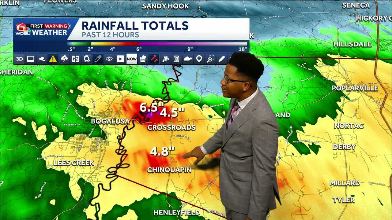
Over the past 12 hours, heavy downpours delivered widespread rainfall totals exceeding 2 inches across portions of the New Orleans metropolitan area, the Northshore, and coastal Mississippi. Localized spots in Washington Parish and Pearl River and Hancock counties recorded between 4 and 6.5 inches of rain. Meanwhile, southern areas, including Terrebonne and Lafourche parishes, remained mostly dry.
Rain activity is expected to taper off around 10 p.m. Friday, giving way to a warm, clear night.
Moving into Saturday, dry conditions are anticipated early in the morning before scattered pop-up showers and thunderstorms redevelop after 1 p.m. The activity will fade by mid-evening, around 7 to 8 p.m. High temperatures will reach the low 90s.
A similar weather pattern will persist through Sunday and Labor Day. High levels of atmospheric moisture mean any slow-moving or training storms could drop heavy rain rates over short periods, prompting a Level 1 Marginal Risk for localized flooding across the region through Monday morning.
For Labor Day on Monday, expect typical late-summer heat with a high temperature around 94 degrees and a 50% chance of scattered afternoon thunderstorms.
Beachgoers heading toward the Mississippi, Alabama, or Florida Gulf Coasts will see favorable conditions, with a low risk of rip currents maintained throughout the holiday weekend.
Higher rain chances will stay in the forecast through midweek before drier air moves into the region on Thursday, lowering rain chances to 20% under mostly sunny skies.
READ MORE:Scattered thunderstorms possible through the Labor Day Weekend in Southeast Louisiana and Mississppi





