The WDSU First Warning Weather Team declares today a WDSU First Warning Alert Day as strong to severe thunderstorms will sweep across the state, accompanied with dangerous heat.
Severe Thunderstorm Warnings In Effect
A SEVERE THUNDERSTORM WARNING has been issued for St. John The Baptist, St. Charles, and, Tangipahoa until 3:15PM.
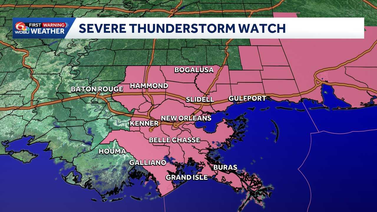
Severe Thunderstorm Watch
A Severe Thunderstorm Watch has in effect for Jefferson, Lafourche, Livingston, Plaquemines, St. Bernard, St. Charles, St. Helena, St. John the Baptist, and St. Tammany Parish until 7 p.m.
Portions of South Mississippi are also under a Severe Thunderstorm Watch.
Storm Prediction Center’s Outlook
The Storm Prediction Center outlines a level 2 of 5 risk for parts of Eastern Louisiana, including New Orleans, Laffite, Baton Rouge and the rest of the North Shore. The level 2 slight risk also extends into southern Mississippi, including parts of Gulfport, Pass Christian and Bay Saint Louis. A marginal, level 1 risk extends further out to the Gulf Coast and as far north as Jackson, Mississippi.
The level 2 threat for severe weather comes with the main threat being damaging winds between 40 and 60 mph. Hail, intense lightning, and isolated flooding can’t be ruled out.
Storm Timeline
- 2 p.m. – 8 p.m.: Tangipahoa, Washington, St. Tammany parishes. Hancock and Pearl River counties.
- 3 p.m. – 10 p.m.: New Orleans Metro, Kenner, and Metairie. St. Bernard, St. James, St. John, northern Jefferson, and northern Lafourche parishes.
- 4 p.m. – 11 p.m.: Grande Isle, Golden Meadow, Houma, Lafitte. Terrebonne, Plaquemines, Lafourche, and southern Jefferson parishes.
READ MORE:Alert Day: Severe Thunderstorm Alerts issued for portions of Southeast, Louisiana, Mississippi





