Tropical Storm Cristobal, the 3rd named storm of the season, officially formed over the Central Subtropical Atlantic Wednesday morning.
The system is located 765mi west of the Azores Islands and is expected to continue moving east-northeast and slow down later today and tonight.
Cristobal is forecast to be a short-lived tropical storm and dissipate on Thursday as it moves over cooler waters and encounters dry air and stronger northerly wind shear.
This system poses no threat to southeast Louisiana or south Mississippi.
STORM INFORMATION:
- Winds: 45 mph.
- Pressure: 1008mb.
- Movement: East at 21 mph.
CENTRAL TROPICAL ATLANTIC:
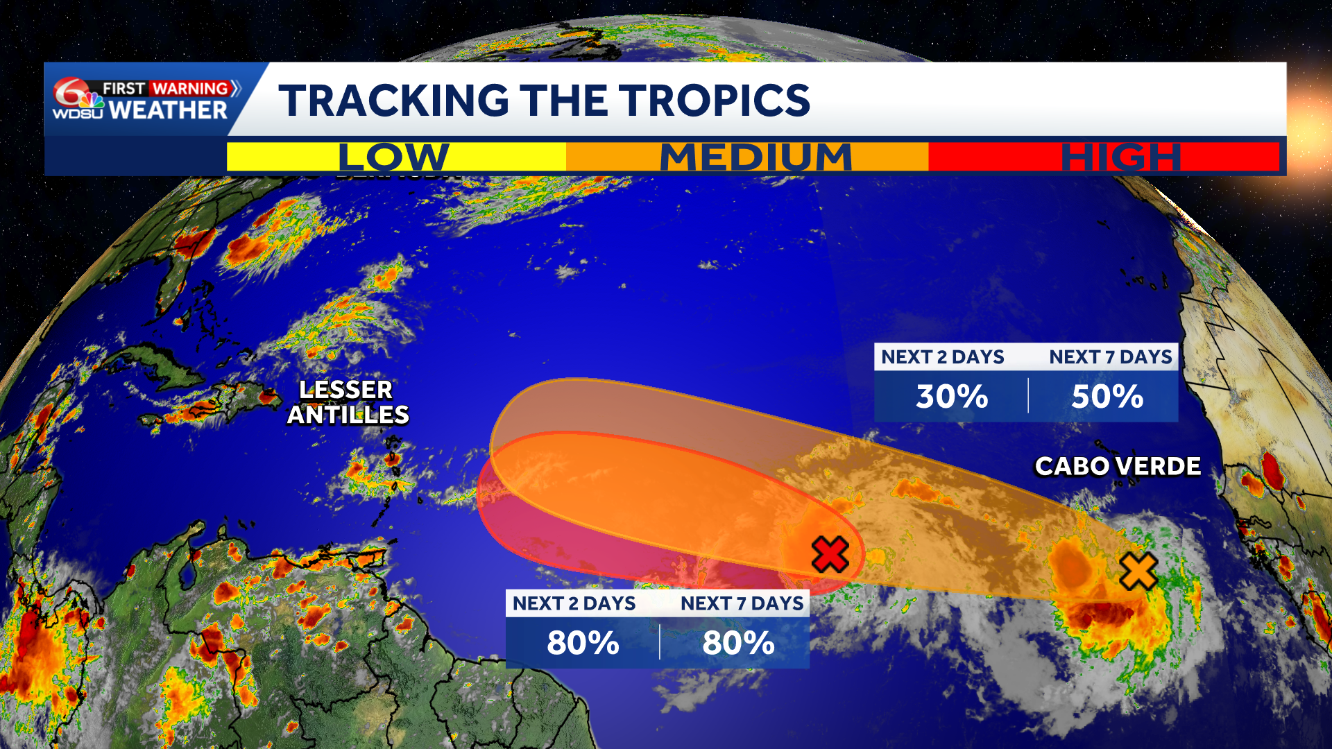
Showers and thunderstorms associated with a tropical wave is located about 950 miles west-southwest of the Cabo Verde Islands. Conditions are forecast to be favorable for development during the next couple of days, and a tropical depression will likely form while the system moves westward to west-northwestward across the central tropical Atlantic.
WHAT WE KNOW:
- Development chances over 1-2 days: High, 80%.
- Development chances over 3-7 days: High, 80%.
- No threat to southeast Louisiana or south Mississippi over the next 7 days.
EASTERN TROPICAL ATLANTIC:
A tropical wave located several hundred miles south of the Cabo Verde Islands is producing disorganized showers and thunderstorms. Conditions are forecast to be generally favorable for some development of this system during the next several days while it moves westward or west-northwestward across the eastern and central tropical Atlantic.
WHAT WE KNOW:
- Development chances over 1-2 days: Low, 30%.
- Development chances over 3-7 days: Medium, 50%.
- No threat to southeast Louisiana or south Mississippi over the next 7 days.
READ MORE:Tropical Storm Cristobal forms over the Central Subtropical Atlantic, watching 2 other systems





