Eastern and Central Tropical Atlantic:
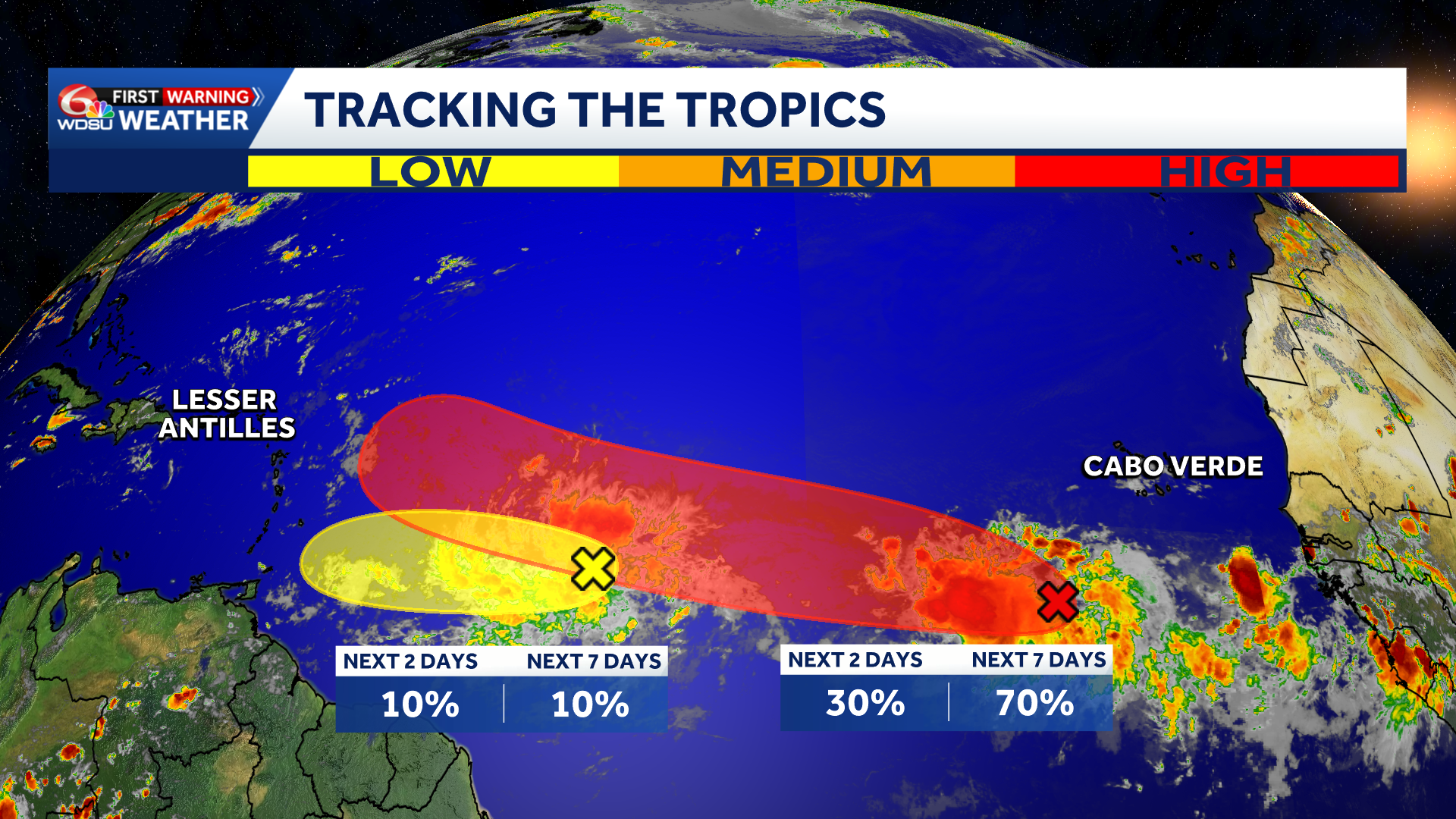
An area of low pressure located a few hundred miles southwest of the Cabo Verde Islands is producing a large area of showers and thunderstorms. Environmental conditions appear favorable for this to become a Tropical Depression or Tropical Storm Cristobal by late week.
Something to watch in the Lesser Antilles by late this upcoming weekend, but most model guidance keeps this system north of the islands at this time.
Development chance 1-2 days: low, 30 percent.
Development chance 3-7 days: high, 70 percent.
Central Tropical Atlantic:
Disorganized showers and thunderstorms associated with a tropical wave are located about midway between the coast of west Africa and the Lesser Antilles. Some gradual development of this system is possible through mid-week while it moves quickly westward across the central tropical Atlantic. Conditions are expected to become less favorable for development later this week as the system approaches the Lesser Antilles due to strong wind shear.
Development chance 1-2 days: low, 10 percent.
Development chance 3-7 days: low, 10 percent.
Western Subtropical Atlantic:
A trough of low pressure located a few hundred miles north of Bermuda is producing disorganized showers and thunderstorms. Some development of this system is possible during the next couple of days while it moves quickly eastward across the western and central subtropical Atlantic. The system is forecast to reach cooler waters later this week, ending its chances of development after Wednesday.
Development chance 1-2 days: low, 10 percent.
Development chance 3-7 days: low, 10 percent.
READ MORE:Tracking the Tropics: Three areas being watched, one with a high chance to develop





