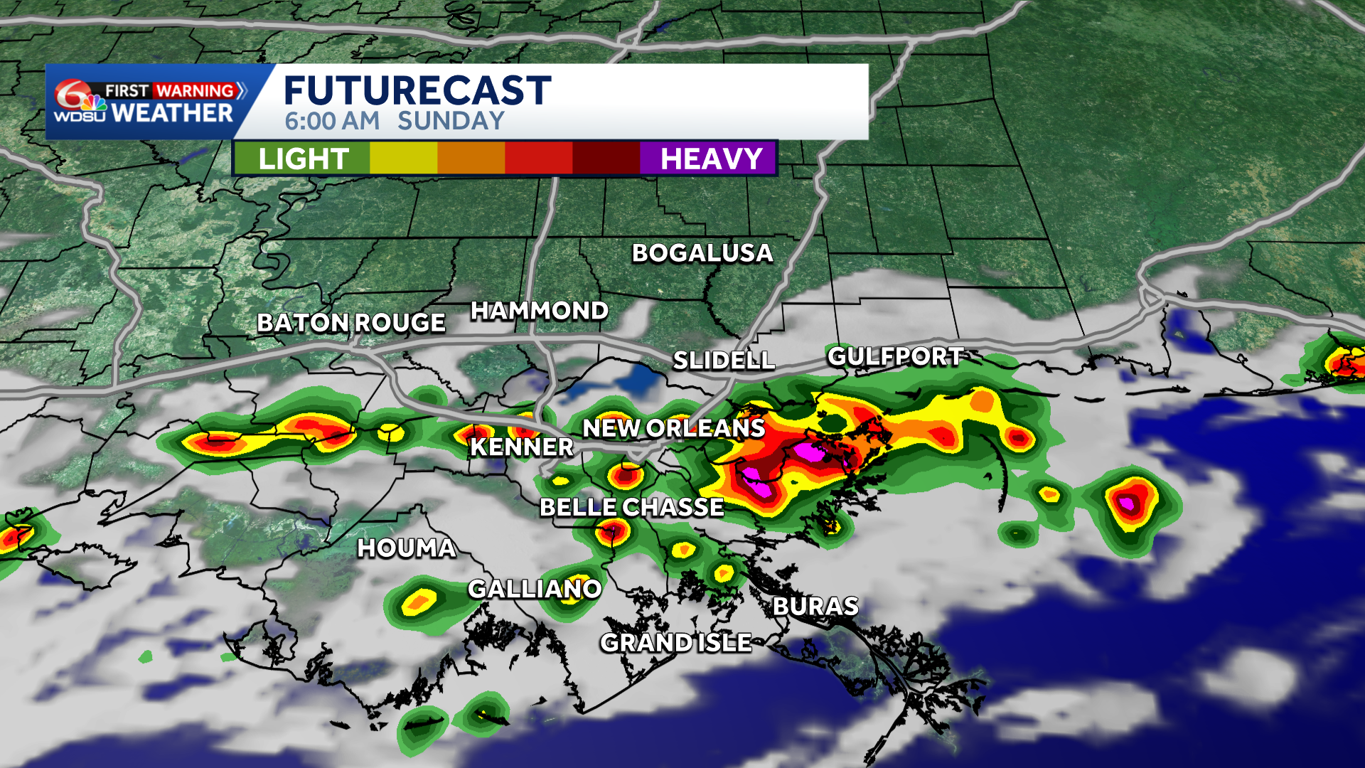
Heads up! This morning is a WDSU First Warning Weather Impact Day due to a low-end risk for flash flooding, mainly along and south of I-10.
An isolated strong storm is possible with gusty winds and offshore waterspouts as the primary hazards.
Localized street flooding possible. Weather Prediction Center has a Marginal (Level 1 out of 4) for flash flooding.
We’ve got some thunderstorms developing across southeast Louisiana and southern Mississippi. Expect coverage to increase through 6-7am along I-10 into Metro New Orleans.
Lightning, brief gusty winds, localized heavy downpours on the South Shore through 9-10am before moving along the coast by 11am-Noon.
National Weather Service mentioning that the environment is very favorable for waterspouts offshore. If you have any reports, please send them our way!
Improving weather conditions Sunday afternoon with slightly lower humidity and a break from the extreme heat Sunday-Tuesday.
READ MORE:Impact Day: Isolated street flooding possible Sunday morning in southeast Louisiana





