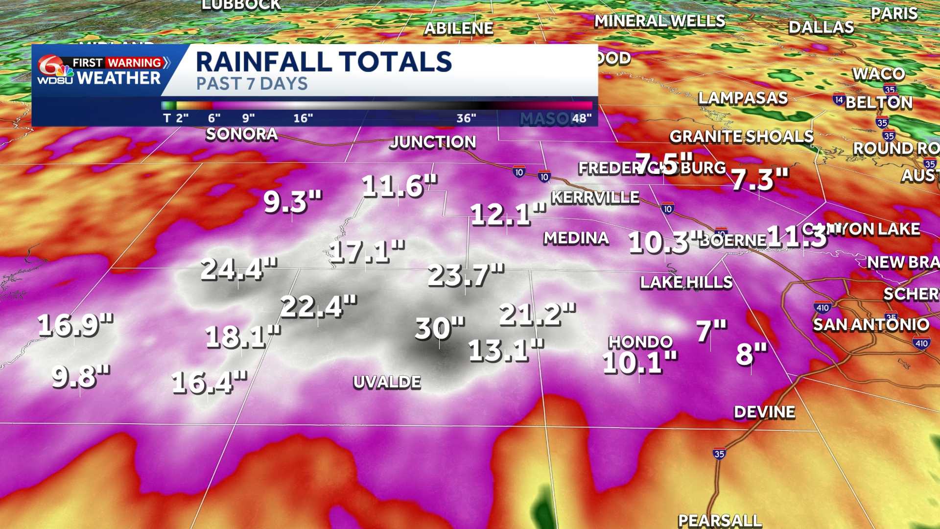
Emergency crews continued rescue operations across Texas on Friday after a relentless weather system dumped historic amounts of rain over a seven-day span.
The staggering rainfall totals have drawn close attention from residents in southeast Louisiana, many of whom have deep regional ties to Texas following displacements from Hurricane Katrina in 2005.Between July 10 and July 17, back-to-back atmospheric setups stalled over Texas, dropping nearly 2.5 feet of water in the hardest-hit areas. The deluge amounts to roughly half of what New Orleans receives in a single year.
According to local weather reports, the intense rain bands overwhelmed local infrastructure, leading to rapid flash flooding and forcing emergency responders to conduct dozens of high-water rescues. In some areas, water levels rose so fast that residents were trapped inside their homes and vehicles before official rainfall measurements could even be finalized.
The extreme weather event was amplified by a slow-moving low-pressure system that continuously pulled moisture from the Gulf of Mexico, trapping the heaviest rain bands directly over central and south Texas counties for days.
The Rain Gauge Totals
The official numbers collected between July 10 and July 17, 2026, paint a vivid picture of the deluge. The highest recorded total came from the Frio River near Knippa, tracking just shy of the 30-inch mark.
– 28.23 inches at Frio River near Knippa
– 27.26 inches at Leona River near Uvalde
– 24.39 inches in Uvalde
– 23.60 inches in Kinnery
– 20.70 inches in Frio River at Concan
– 20.94 inches at Frio River below Dry Frio River near Uvalde
– 21.83 inches in North Uvalde
– 21.50 inches in Nueces River at Laguna
– 19.20 inches in Johnson Creek near Ingram
– 19.10 inches in Uvalde
– 18.96 inches in Kickapoo Caverns
– 17.58 inches in Harper
READ MORE:‘Catastrophic’ Texas deluge draws striking parallels to Gulf Coast’s heaviest historical rainstorms





