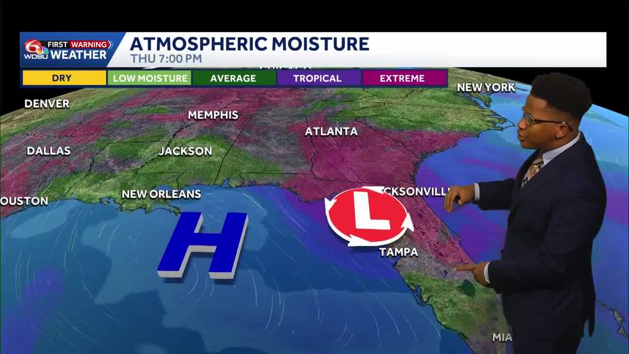
Southeast Louisiana is bracing for a sustained wave of intense summer heat as a massive high-pressure system settles over the Gulf of Mexico, suppressing widespread rainfall but driving heat indices toward dangerous triple-digit territory over the coming week.
While Southeast Louisiana will stay largely shielded from tropical development, we will have to contend with a steady upward climb in temperature and humidity.
High Pressure Acts as a Double-Edged Sword
A dominant high-pressure system currently positioned in the Gulf is forecast to slowly meander closer to southeast Louisiana over the next several days. While this system will keep local rain chances exceptionally low, it will also act as a pressure cooker for the region.
On the tropical front, the National Hurricane Center is currently monitoring an area of potential development in the eastern Gulf of Mexico, extending across the Florida peninsula and into the western Atlantic. The proximity of the high-pressure system will act as a shield for southeast Louisiana, steering the deepest tropical moisture eastward.
The closer that high gets to us, the lower our rain chances. The bulk of the tropical moisture and heavy rainfall—estimated at 2 to 3 inches—will remain confined to Florida, Georgia, and Alabama.
Dangerous Heat on the Horizon
With the high-pressure system suppressing cloud cover and precipitation, temperatures will easily climb into the mid-90s daily, sending heat indices soaring.
- Wednesday: Heat index values are expected to climb to around 100°F, with actual afternoon high temperatures topping out in the lower 90s.
- Thursday: Increased humidity will push the feels-like temperature to a stifling 105°F to 108°F.
- The Extended Forecast: The heat index is projected to climb daily, potentially reaching a grueling 109°F by next Tuesday.
Take standard heat precautions: stay hydrated, take frequent breaks in air-conditioned spaces, and limit strenuous outdoor activity during peak heating hours.
Isolated Storms Offer Little Relief
While widespread rain is off the table, the daily summer routine of spotty afternoon showers will continue. Rain chances peak on Wednesday at 30% before dropping to a meager 10% to 20% through the weekend and into next week.
Any storms that do manage to bubble up will form along local sea and lake breezes after midday, drifting across the metro area and the Northshore before fading by late evening. Those who do get storm will definitely pack a punch, but they will be very far few and in between.
Adding to the dry, stable pattern is a plume of Saharan dust modeled to drift across the Gulf Coast over the next several days. This dry air mass is expected to further suppress tropical activity and keep regional rain chances minimal.
READ MORE:Louisiana’s weather forecast: Tracking the tropics, heat and summer storms





