Today is a WDSU First Warning Weather Impact Day as we’re under a heat advisory plus the chance for storms this evening that could be strong to severe.
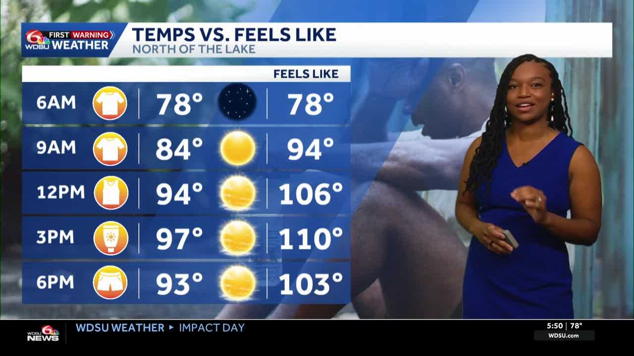
Let’s talk about the Heat Advisory. It’s in effect from 11 a.m. to 6 p.m. as highs reach the mid 90s but could feel as hot as 105-110.
Most of our day will stay dry, but there is a chance a few storms arrive late this evening and fade before night. There is also a possibility that some of these storms may not even hold together. If they do, they could contain lots of lightning, heavy downpours, and strong winds.
Wednesday looks to be the day with the most rain. We’ll see showers and storms arrive in the afternoon and stay scattered throughout the day.
Highs will be in the low 90s.
For Thursday through the weekend, we will likely return to our typical summertime pattern of heat and scattered afternoon storms.
We’re not expecting a washout for the 4th of July, but chances for storms are possible along with highs in the 90s.
READ MORE:Impact Day: Heat Advisory-feeling up to 110 plus storms possible later


