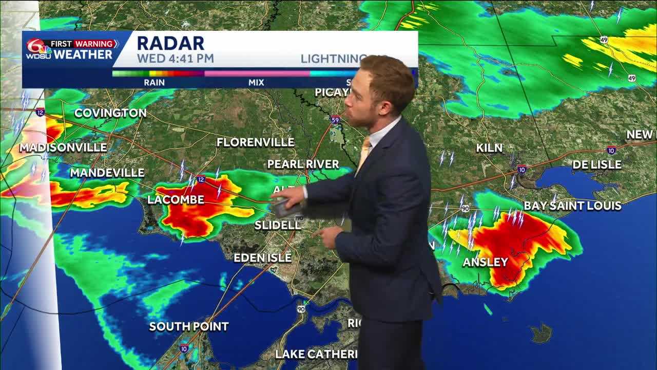
The heat and humidity will fuel strong thunderstorms across southeast Louisiana this evening. Many communities will remain dry, but those who see storms, it could pack a punch.
The Storm Prediction Center outlines a level 1 of 5 marginal risk for severe weather across the Northshore and southern Mississippi. The main threats include gusty winds, heavy downpours, and intense lightning. Water spouts can’t be ruled out, but ultimately the threat is low. Localized flooding could also develop in areas who see the heaviest downpours for an extended period of time.
Scattered storms will last through the evening, likely clearing by 11 p.m.
Aside from the strong storms today, and the isolated storm threat the rest of the week. Louisiana stays hot and humid. Highs will settle in the 90s daily, with heat indices above 100 degrees every afternoon.
Lows tonight will fall to the 70s and will continue to feel muggy.
Highs for Thursday through the weekend will be in the low 90s, feeling like the triple digits.
There will be small daily rain chances, but most areas will stay dry.
By the end of the weekend, we could be looking at even hotter weather, so be on the lookout for potential heat advisories.
READ MORE:Impact Day: Hot, humid, and strong storms possible in Southeast Louisiana


