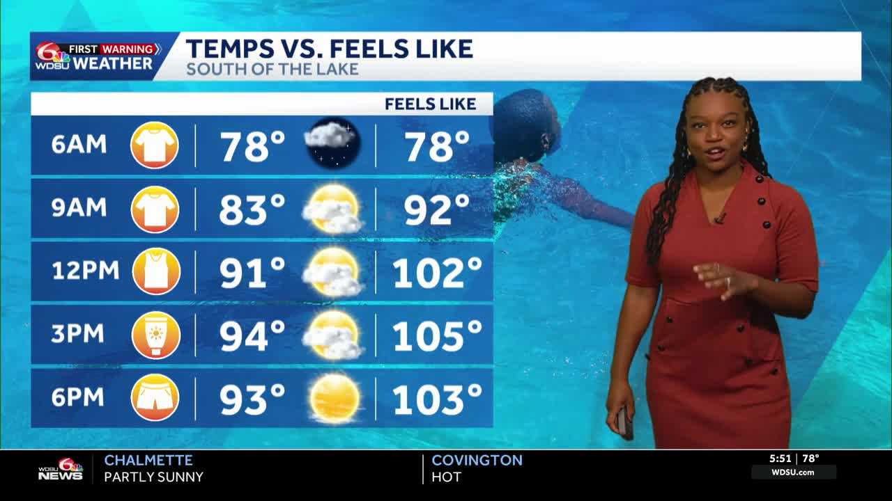
Today is a WDSU First Warning Weather Impact Day as another Heat Advisory is in effect until 8 p.m. for areas surrounding Lake Pontchartrain. Temperatures could feel like 105 to 110 today.
The first half of the day stays dry with a few clouds rolling in as rain in Central Mississippi tries to move down to our area. It likely won’t reach us this morning due to a stable atmosphere. By 3 p.m., we should see spotty storms, with heavy downpours possible throughout the late afternoon and evening, especially areas near the River Parishes and the the metro.
Highs today reach the low to mid 90s, just a tad bit above average.
Highs will feel like 105 to 110 at times if not impacted by the rain or clouds.
It will be muggy tonight with lows in the mid 70s.
Another hot day is expected Wednesday and into the rest of the week with highs in the low 90s all week! There will be 20-30% rain chances throughout the week, but the main headline will continue to be the heat.
READ MORE:Impact Day: Feeling like 105 and above with spotty afternoon downpours today


