Finally, we’re drying out! Sadly, we know what that means…we’re heating up!
Tuesday is another WDSU First Warning Weather Impact Day due to dangerous heat.
Underneath the ridge of high pressure this week, our temperatures will be climbing across the Gulf Coast! Highs in the low-mid 90s with heat index/feel-like temperatures 105-110. Daily heat advisories likely.
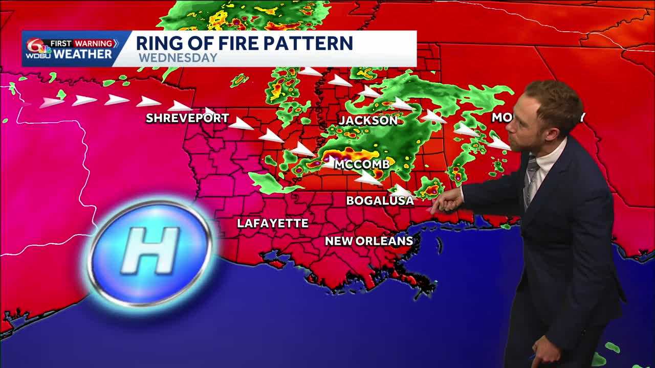
Around the outer edges of the “ring of fire” pattern, complexes of daily storms will fire up! A few of these could be strong to severe with gusty winds, frequent lightning and localized heavy rain.
The good news? The overall trend for most waterlogged areas is a drier week. However, don’t be surprised if a few storms move try to move into sections of south Alabama, Mississippi & southeast Louisiana Wednesday afternoon and Thursday afternoon.
READ MORE:Impact Day: Hot, steamy Tuesday. Few storms my Wednesday


