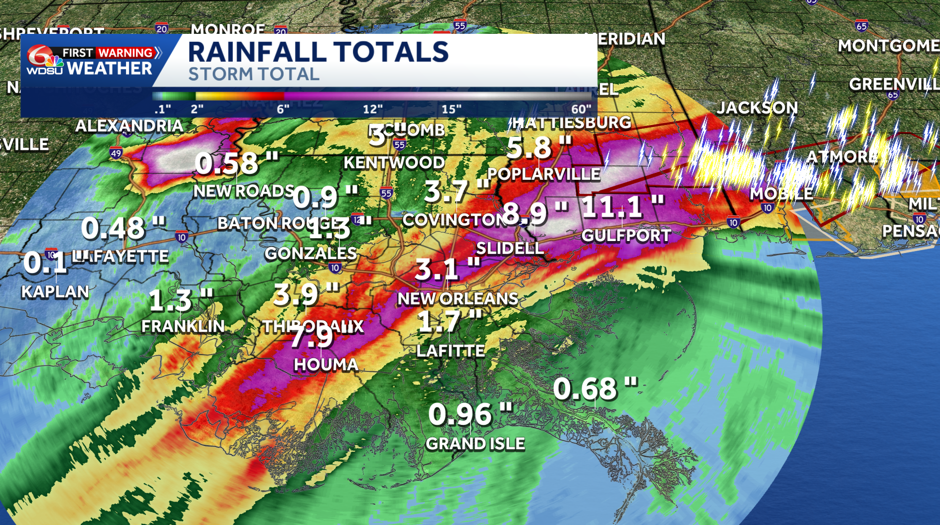
Here are the rainfall totals that were estimated and recorded across southeast Louisiana and south Mississippi.
Doppler Radar Estimates:
Radar estimates show that the highest rainfall accumulations were in a narrowly confined line from the Bayou northeast to south Mississippi, where some areas estimated to pick up 8-11in.
The rest of the area is estimated to have picked up 1-3in.
Actual Observations:
North of the Kiln saw the highest rainfall totals of 9.84in.
Here are the rest of some of the highest rainfall totals from the past 24 hours.
Record Rainfall:
New Orleans Armstrong Airport recorded 7.75″ of rain today which breaks the old record of 1.74″ set back in 1957.
This also sets a new record for the wettest June day ever, beating the old record of 5.98″ from June 6 2001 from Tropical Storm Allison.
READ MORE:Rainfall totals for southeast Louisiana and south Mississippi


