WHAT WERE TRACKING:
Low pressure over Mexico could re-emerge over the northwestern Gulf this week and has a low chance of tropical development.
WHAT IS THE TIMING OF WEATHER?:
Regardless of development, this system will interact with an approaching cold front and will give way to increasing moisture leading to a heavy rain threat this week.
The heaviest rain is likely to occur Monday and Tuesday.
WHAT ARE THE IMPACTS?:
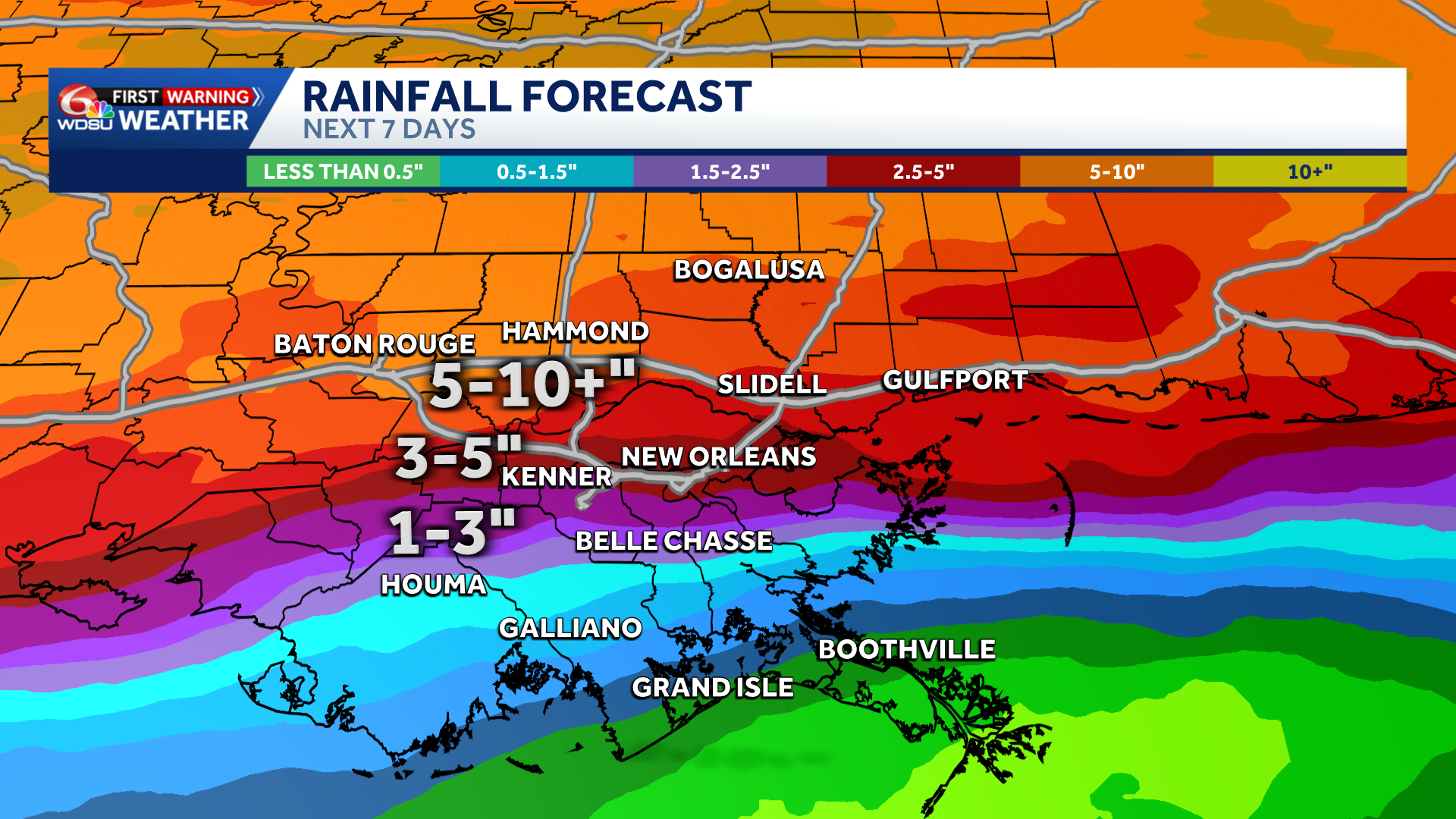
The main impacts this week will be heavy rain and flooding across much of the southern U.S. where rainfall accumulations of 5-10in+ will be possible.
5-10in with locally higher amounts will also be possible over the Northshore and south Mississippi. 3-5in for the river parishes and metro, and 1-3in for the bayou and coast.
It’s important to note that these numbers are subject to change.
HOW SHOULD I PREPARE?
Even though significant tropical development is not expected, residents and visitors of southeast Louisiana and south Mississippi should be preparing for rainy days this week with flooding also possible.
If you encounter flooding, turn around and find another route.
Stay with the WDSU First Warning Weather Team for the latest on this developing weather situation.
READ MORE:Heavy rain threat for much of this week, flooding possible


