Heads up!
Another round of scattered storms likely on Wednesday with highest rain coverage on the South Shore. Few storms may produce localized heavy rain risk and minor street flooding.
By Thursday, slightly drier air under high pressure may keep rain chances a bit more confined to coastal zones before tropical moisture surges back north by Friday-Saturday.
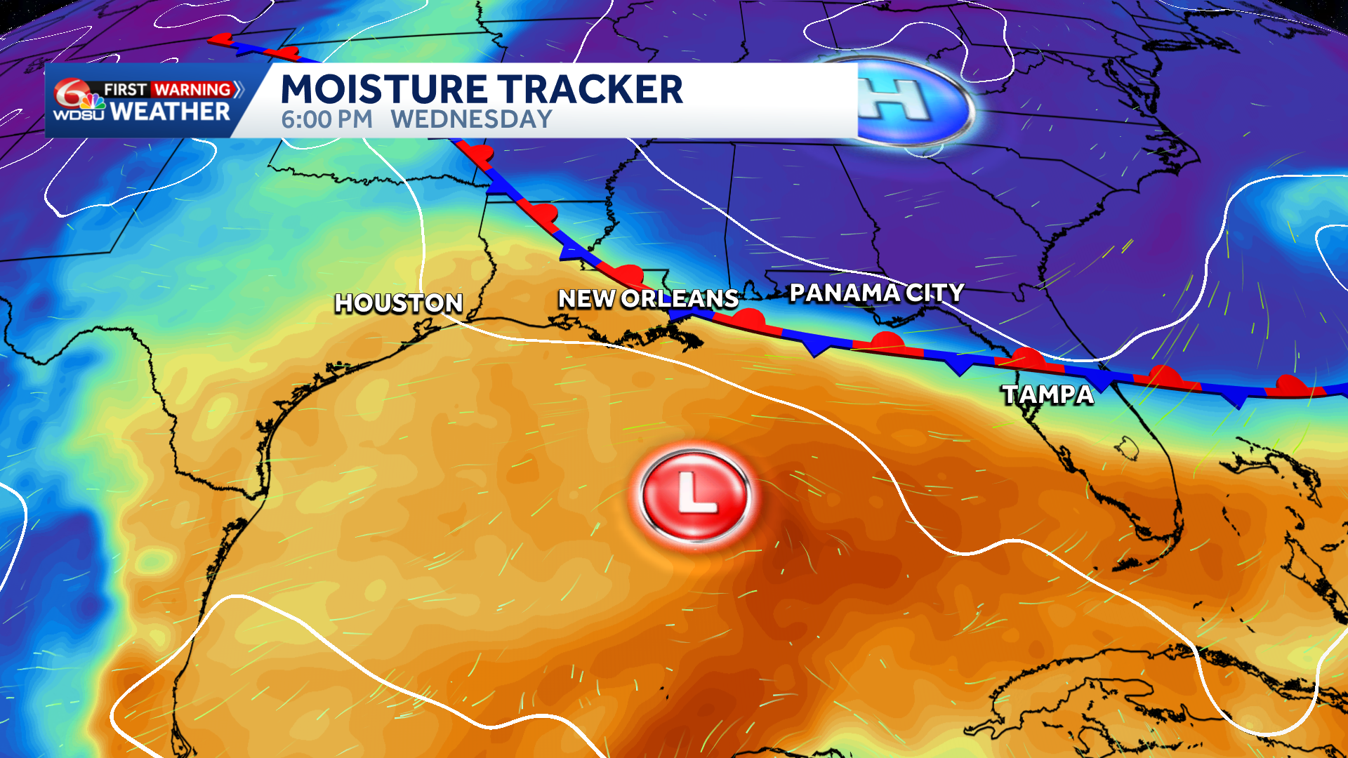
An unnamed Gulf disturbance is going to bring some impacts to the Gulf Coast by mid-week, and it could linger into the weekend. Increased rain chances, breezy conditions, and minor coastal flooding will be the concerns.
The good news? Wind shear and dry air will keep conditions hostile for any organized tropical development. Regardless of organized development into a named storm, this disturbance will cause choppy offshore conditions.
A strong high to the north over the Appalachians combined with lowering pressures over the Gulf is tightening the pressure gradient. That means gusty to windy conditions offshore Wednesday through Friday, small craft advisories are expected.
On top of that, minor coastal flooding for Southeast Louisiana and South Mississippi. Highest water levels mainly Thursday with water running 1 to 2+ feet above normal.
The tricky part of this forecast? Rain coverage. Slow-moving storms are possible Wednesday through Friday, and right now it’s still unclear whether that rainfall stays offshore or pushes inland.
Stay tuned! I’ll have more updates coming as this unnamed feature develops.
READ MORE:Impact Day Wednesday: Breezy, Localized Heavy Rain Possible


