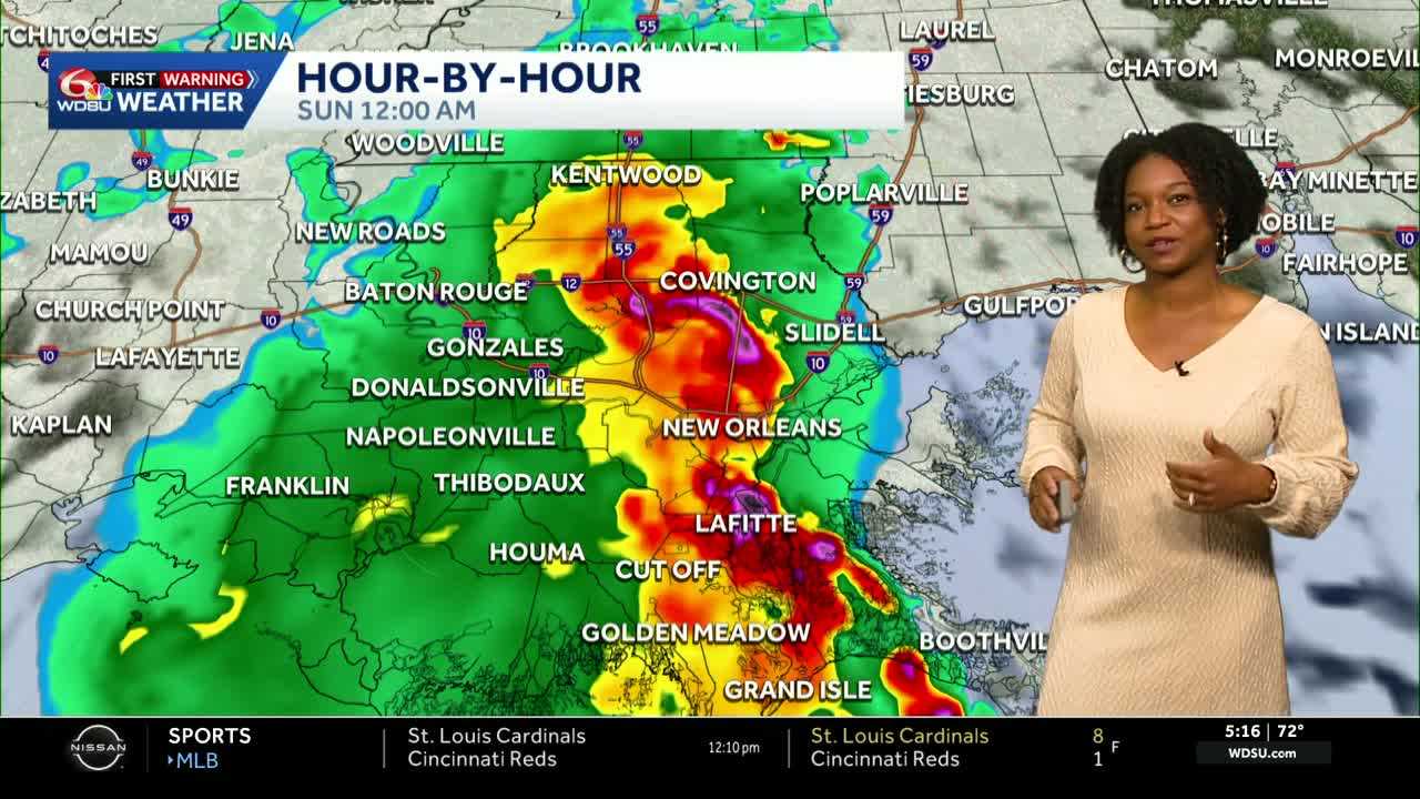
Today is a WDSU First Warning Weather Impact Day due to more heavy rain and the potential for flash flooding across the area.
Most of the area has already seen a couple of inches of rain over the past couple of days, so the ground is very saturated.
There was an earlier severe storm threat, but that is no longer the case after a very rainy start to our Saturday. Most of the rain worked over the atmosphere and suppressed our severe weather threat.
As we continue into the rest of the evening and overnight hours, we have the potential to see more rain enter the picture, which could lead to additional issues across the already saturated ground.
We are still under a marginal risk or level 1 threat for severe weather through Sunday morning with the main impacts being strong winds and heavy rain.
Lows tonight fall to 69-76 degrees.
Models have been struggling over the past 24-48 hours with the accuracy of rain placement and timing. As of now, expect rain to be on and off throughout the day on Sunday with highs reaching 81-85 degrees if not impacted by rain.
More rain is ahead for Memorial Day with another chance to see street flooding. There is the possibility that the Flood Watch could get extended into Monday because of the additional rainfall expected.
We are basically stuck in the same pattern as we look ahead to next week with more chances for rain expected every day. Those chances will decrease by Friday and Saturday with highs remaining in the 80s all week.
READ MORE:Impact Day: heavy rain, flood threat continues for the rest of Memorial Day Weekend


