Heads up! Tomorrow is another WDSU First Warning Weather Alert Day for the potential of heavy rain, flash flooding & isolated severe storms.
Few spotty showers, downpours possible Friday evening. The unsettled pattern continues overnight with isolated downpours before 6AM, mainly north of the lake.
High-resolution model guidance is once again coming in HOT with tomorrow’s round of storms by mid morning. Localized flash flooding and isolated severe weather possible. Main concern of heavy rain, gusty winds, small hail, lightning.
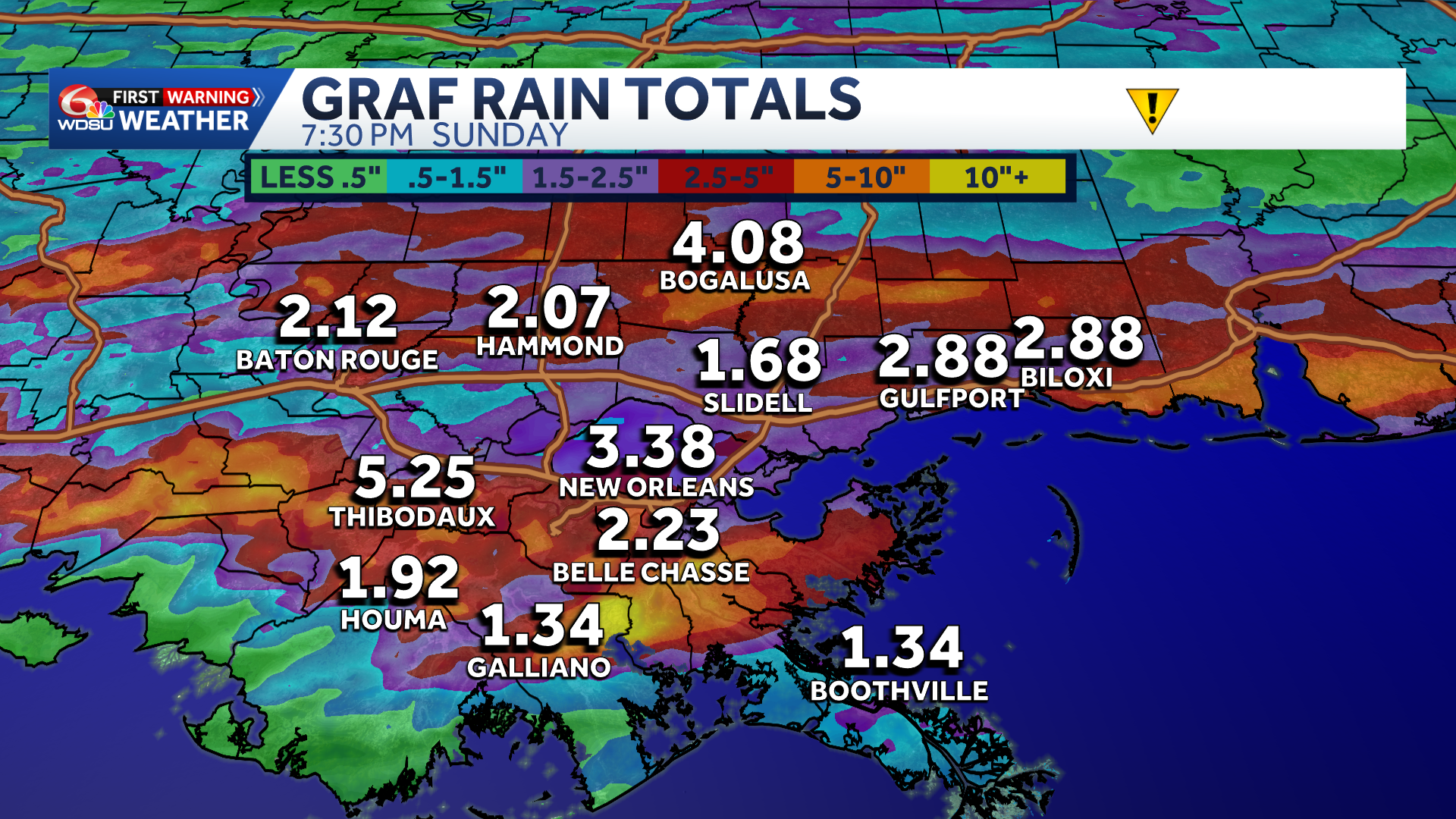
The Weather Prediction Center has upgraded the flash flood threat to Slight(Level 2 out of 4.) Widespread 1-3″ of rain likely. Hot spots of 4+ inches possible.
With soils being a bit more soggy from today’s heavy rain in spots, the flood risk could quickly elevate with any training of storms. Stay alert.
Timing has trended earlier with storms developing by 6AM-10AM across the Northshore and continuing into the early afternoon across the South Shore.
We may see a nice break by the afternoon?! Additional scattered storms possible into the late afternoon/evening, but that part of the forecast is a bit more uncertain.
By Sunday, the first half of the day looks more tranquil before additional storms possible Sunday afternoon into Sunday night.
Finally, by Monday, this stubborn weather pattern looks to exit with much nicer weather early next week.
READ MORE:Rain, potential for severe weather could impact Mother’s Day weekend events


