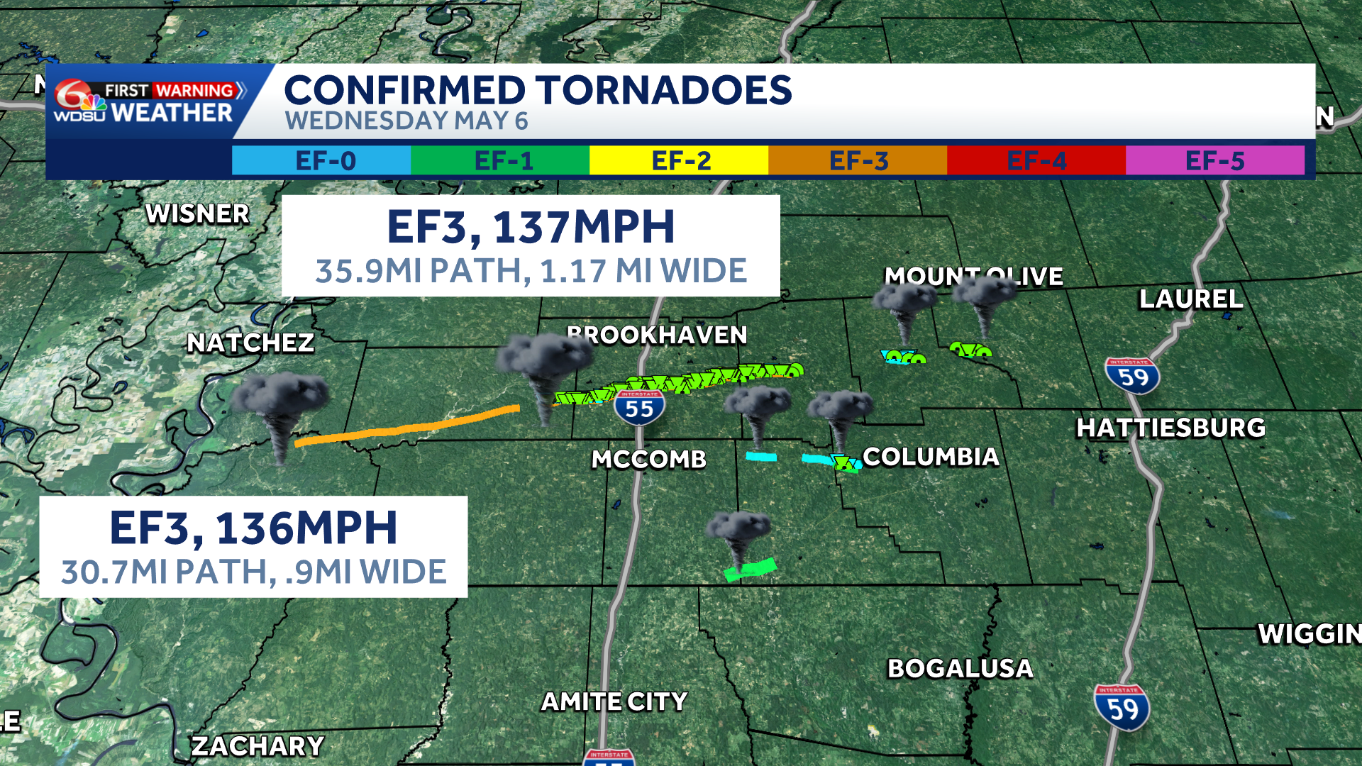
National Weather Service survey teams are still assessing several likely tornadoes across Mississippi. Here are the highest preliminary ratings so far:
EF3: Lincoln County tornado, extending from south of McCall Creek in eastern Franklin County to near Monticello in Lawrence County.
EF2: Wilkinson/Adams County into Franklin County near Bude/Garden City.
More details will likely change as surveys continue.
The National Weather Service confirmed tornado damage in several areas across Mississippi that touched down Wednesday night.
In northern Wilkinson County, Mississippi, a long-track tornado was confirmed, but survey crews are still assessing the damage and havent rated the storm yet.
Near Enon in northern Walthall County, Mississippi, an EF0 tornado with peak winds of 85 mph caused minor damage, including uprooted trees, snapped trunks, porch roof damage and shingle damage to a church.
Another EF0 tornado near Darbun in northeast Walthall County, Mississippi, with peak winds of 80 mph, caused tree damage and downed large branches as it moved into Marion County.
The strongest confirmed tornado was an EF1 in the Smithburg-Dillon area, stretching from southeast Pike County into southwest Walthall County, Mississippi.
This storm triggered Tornado Warnings in Washington Parish and a Severe Thunderstorm Warning in Tangipahoa Parish Wednesday evening.
That tornado had peak winds of 90 mph and caused more significant damage, including uprooted and snapped trees and downed wooden transmission lines, according to the National Weather Service.
Crews from the National Weather Service are continuing to survey damage.
READ MORE:National Weather Service releases preliminary tornado ratings in Mississippi


