Today is a WDSU First Warning Weather Impact Day due to the risk for heavy rain, especially during Jazz Fest.
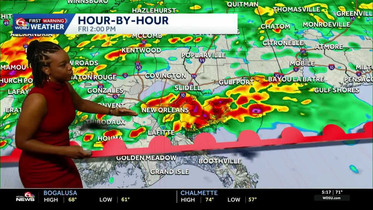
Timing:
- Noon: isolated storms arrive on the coast and move inland.
- 2 p.m.-8 p.m. : storms arrive in New Orleans and will continue to cover the metro and Northshore on and off, heavy at times.
- 8 p.m. – midnight: scattered showers and storms continue
- Midnight to 3 a.m. : main line of storms moves across the entire area from the west
- 3 a.m.-9 a.m. : lingering showers moving out
Impacts:
- Heavy downpours-flash flood potential
- Lightning
- Strong to damaging winds
- Low-end threat for tornadoes
- low-end threat for hail
After the storms move out Saturday morning, expect much cooler air and windy conditions on Saturday. Temperatures throughout the day on Saturday will be in the 60s and low 70s. We could see gusts up to 25 mph.
For Sunday, expect temperatures to be in the low to mid 70s with sunshine.
Temperatures will gradually warm back up next week to the 80s.
READ MORE:Impact Day: Showers, storms expected today, heavy downpours and severe weather possible


