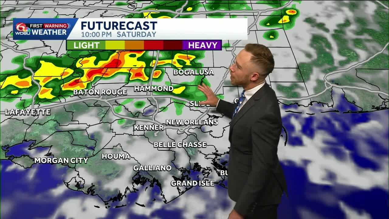
Heads up! WDSU First Warning Weather Impact Days posted Saturday-early Sunday for the isolated severe weather potential.
A few spotty to scattered storms likely again Thursday. A lot of these will be hit or miss, but if you do see rain, you could experience some brief heavy downpours.
Highs today will reach 80-84 degrees with partly cloudy skies when it’s not raining.
Most of the rain will clear out by the evening with overnight lows 65-70 degrees.
Rain is still expected in the forecast for Friday, but the chances look less than previous days. When rain does happen, it will most likely be for the afternoon.
Highs will the low to mid 80s for Friday.
There is a chance for an isolated shower early Saturday morning if you’re heading to the Crescent City Classic.
Then once we get to the afternoon, rain chances will ramp up. There is a Marginal Risk(Level 1 out of 5) for severe weather late Saturday into early Sunday morning as a cold front moves in.
While the risk is low, there is a chance for damaging winds, small hail, frequent lightning and localized heavy rain.
Rain is trending to move out or lighten up by Sunday afternoon. Behind the front, cooler air will spill in with highs Sunday in the low 70s. Few spotty showers remain possible into late Sunday-early Monday.
By Monday, highs will be in the upper 60s to low 70s. We’ll also see near to slightly below average temperatures Tuesday and Wednesday
READ MORE:Spotty Rain Thursday-Friday, Isolated Severe Risk Saturday-Early Sunday!


