Today is a WDSU First Warning Weather Impact Day as the entire area is under a Dense Fog Advisory until 9 a.m.
Some spots this morning could see visibility reduced to less than a mile for the morning commute.
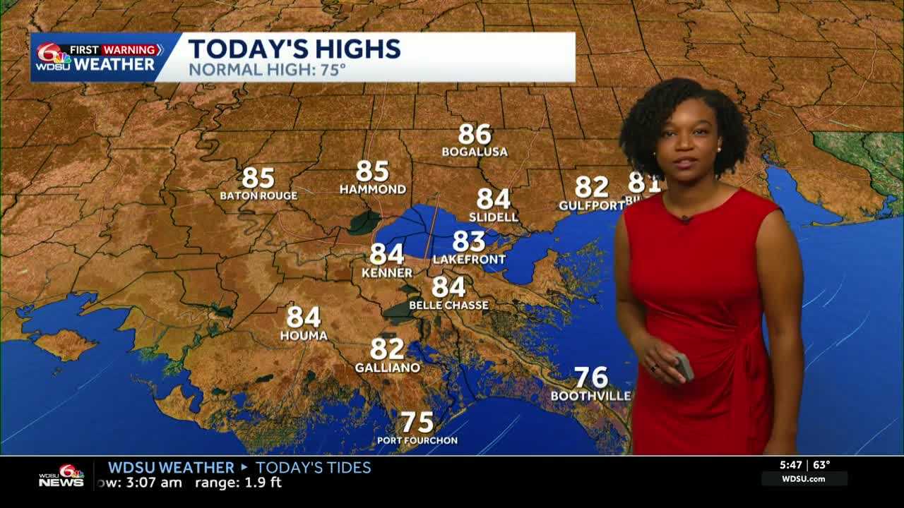
After the fog clears, expect partly cloudy skies and slightly warmer temperatures compared to Thursday.
Highs reach 82-86 degrees with partly cloudy skies. A few spots will be close to record-breaking temperatures.
A cold front moves in tonight into early Saturday morning bringing in breezy conditions and drier air.
Because of that, we are looking at a Fire Weather Watch Saturday for the Northshore as humidity is expected to be very low on top of drought conditions.
Highs Saturday will drop to near average in the mid 70s with partly cloudy skies and breezy conditions.
For Sunday, expect highs to also be in the 70s but maybe a degree or two higher than Saturday.
We’ll also introduce daily rain chances starting Sunday! We could really use it! A slight chance Sunday then about a 30-40% chance starting Monday through next week.
READ MORE:Impact Day: Dense Fog Advisory Friday morning before a cold front brings cooler air


