There is a chance for a spotty strong storm in the afternoon, but most areas will stay dry.
An isolated strong or marginally severe storm possible north of the lake this afternoon-early evening.
Lows tonight drop to the mid to upper 60s with another chance for patchy fog to develop.
Highs Tuesday and Wednesday are both in the mid 80s, which could break records.
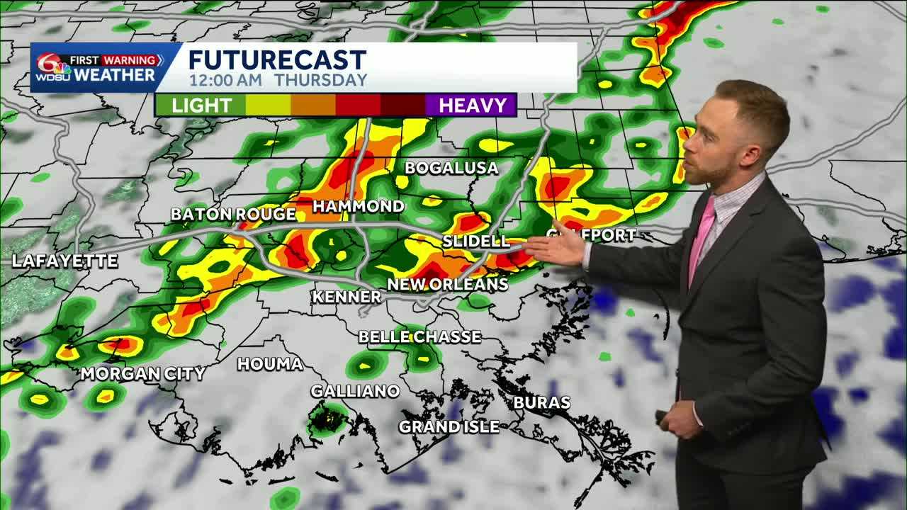
Another round of active weather likely late Wednesday into Wednesday night-Thursday morning. Potential for a few strong to severe thunderstorms.
Storm Prediction Center has placed a Marginal (Level 1 out of 5) Risk to a Slight (Level 2 out of 5) Risk for severe storms in much of south Louisiana. Higher risk north of the I/10 corridor.
Main concern of gusty winds, localized heavy rain & frequent lightning. Isolated tornado possible. Hi-res model guidance indicates Wednesday evening into Wednesday night as the primary time frame.
Behind that system will be much cooler air with highs Thursday in the upper 60s to low 70s!
That brief cooldown doesn’t last long. By Friday, highs rise back above average. 80s are expected at the end of the weekend.
READ MORE:Isolated severe risk Monday, more numerous thunderstorms late Wednesday.


