After a very cold start across southeast Louisiana and south Mississippi, we’re warming up! Spring incoming over the next 7-10 days with abnormally warm temperatures likely.
Highs on Tuesday will be in the low 60s, still below are average temperature of 68 degrees. Lows tonight will fall to the 40s and 50s.
An Elevated Fire Risk continues today with very low humidity and persistent drought conditions. Avoid burning if possible.
Winds will be begin to come out of the south today, which will contribute to the humidity rising by Wednesday and warmer temperatures.
Highs on Wednesday return back to the mid 70s with winds from the south at 10-15 mph. Clouds will increase throughout the day and by the night. Expect very mild lows with temperatures only falling to the 60s.
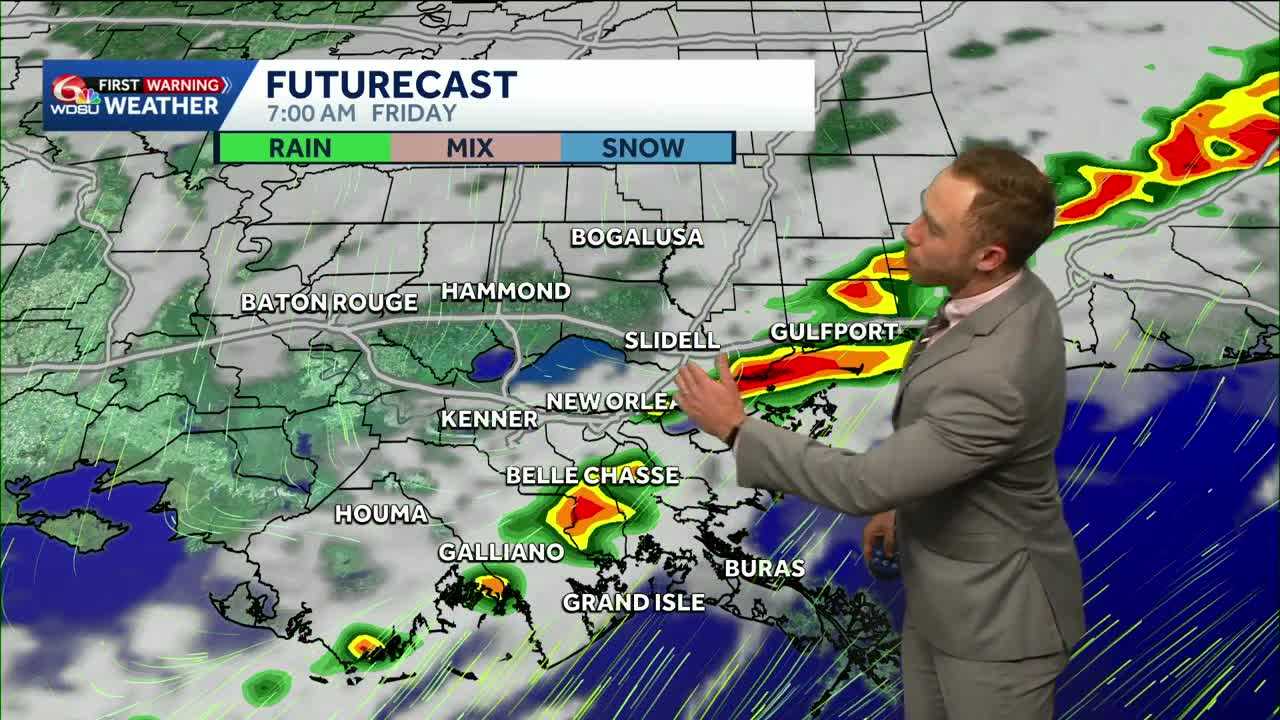
We are looking at rain chances to return late Thursday into Friday morning. Right now, most model guidance showcases the best probability for rain early Friday morning-mid day.
This rain will do very little to help out our drought situation. Most areas can expect less than half an inch.
This cold front will do little to drop our temperatures.
Expect highs to remain above average in the 70s through the weekend into next week.
READ MORE:Spring incoming! Big warmup on the way along with late week rain chance.


