Warm weather fans, soak up the heat today and Saturday! A strong cold front will drop temperatures sharply by Sunday.
Expect a mix of sun and clouds for Friday. A stray shower or downpour is possible, but most locations will stay dry.
We will likely tie or break the record high temperature for today’s date of 83 degrees. Right now, I’ve got the projected high at 84.
Heading into the overnight hours, expect more fog to potentially develop. Clouds increase tonight with lows in the upper 50s to mid 60s.
Another warm day is expected Saturday as highs reach the low 80s. A cold front moves in, bringing showers and a few thunderstorms late Saturday evening to the area. No severe weather anticipated, but an isolated rumble of thunder possible.
By Sunday, our temperatures are expected to drop back to near average in the low 60s.
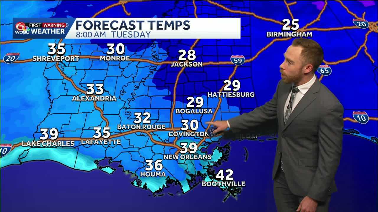
A cold start is expected to next Monday and Tuesday with potential morning lows in the 30s on the Northshore. A light freeze likely Monday night-Tuesday morning across the Northshore.
The good news for my cold weather haters? We will be back in the mid 70s by next Wednesday!
READ MORE:Record warmth Friday and Saturday ahead of big temperature tumble by Sunday


