Friday morning is starting off on the warm and muggy side. Temperatures out the door are in the upper 60s to low 70s.
Expect a mostly cloudy start like previous days, but clearing is expected throughout the afternoon. This will allow us to once again warm up to the low 80s.
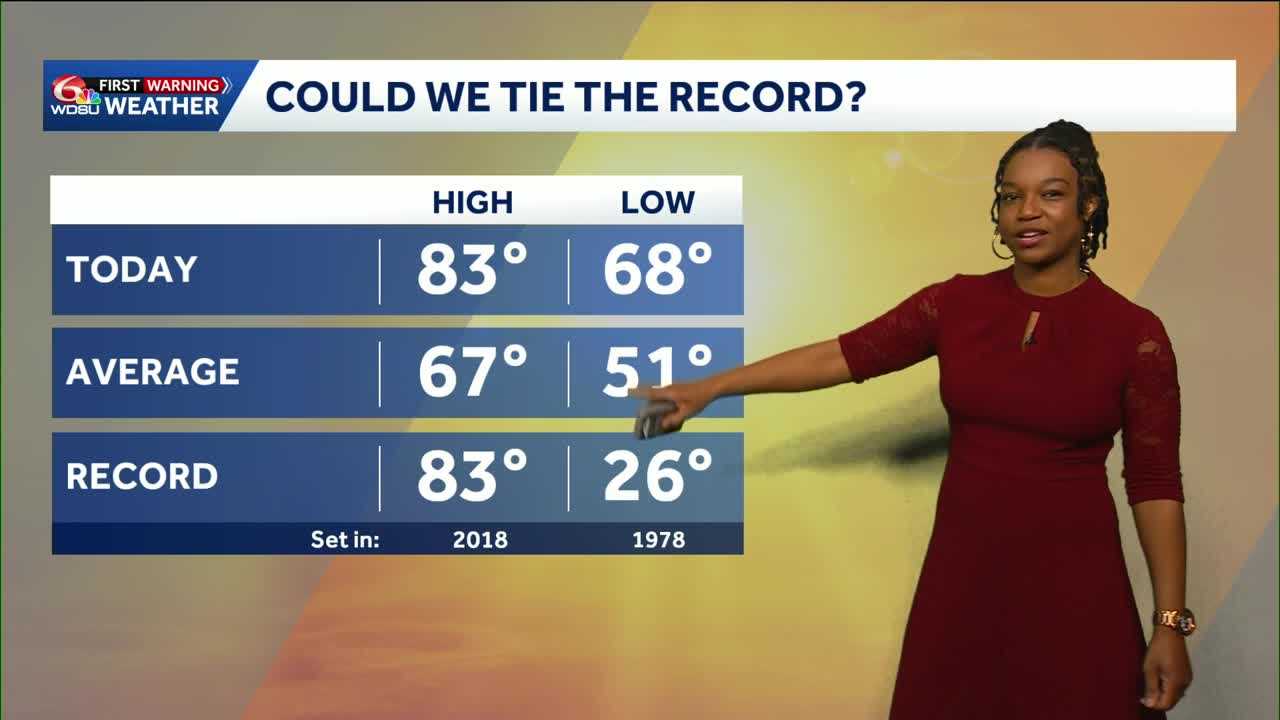
There is another chance we could get close to breaking records or at least getting close to it.
Winds will be 5-15 mph coming from the south, so plenty of warm, moist air will be pumped into the area.
There is a small chance for a few scattered showers, but most areas will stay dry.
Heading into the overnight hours, expect more fog to potentially develop. Clouds increase tonight with lows in the upper 50s to mid 60s.
Another warm day is expected Saturday as highs reach the low 80s. A cold front moves in, bringing showers to the area.
By Sunday, our temperatures are expected to drop back to near average in the low 60s.
A cold start is expected to next Monday and Tuesday with potential morning lows in the 30s on the Northshore.
READ MORE:Another potential to break a record before a big drop in temperatures


