Heads up! Mostly dry and mild through Friday ahead of potent storm system late Saturday night-Sunday. A WDSU First Warning Weather Alert Day has been posted for Sunday with the potential of a few strong to severe storms. Here’s the latest:
Afternoon highs on Thursday reach 70-74 degrees with partly to mostly cloudy skies.
There could be a spotty shower or two this afternoon, but most of us will likely stay dry.
Heading out to any of today’s parades should be fine with temperatures in the 60s.
Lows tonight fall to the 50s once again.
Friday’s highs reach the low 70s.
Friday’s parade forecast looks similar to Thursday with temperatures in the 60s, eventually falling to the 50s.
There is a chance for spotty showers Saturday afternoon. There is the possibility that a few of these showers could happen during the parades.
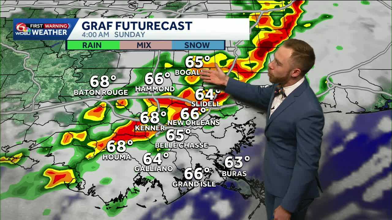
There is a little bit of good news however. If current timing holds as forecast, parades will roll in New Orleans as planned with heaviest rain and storms early Sunday 2AM-8AM.
Strong squall line likely late Saturday night-Sunday morning. Damaging winds 45-60mph & embedded tornado threat in south Louisiana/Mississippi. As things stand now, we’re looking at a few strong to severe storms possible, but not a widespread outbreak.
Worth noting that winds will remain gusty behind this storm on Sunday! Winds 25-35mph with a few spotty lingering storms possible Sunday afternoon. Wind advisories likely in Metro New Orleans. Stay tuned!
READ MORE:Warm, partly cloudy forecast for today’s parades, latest on weekend storms


