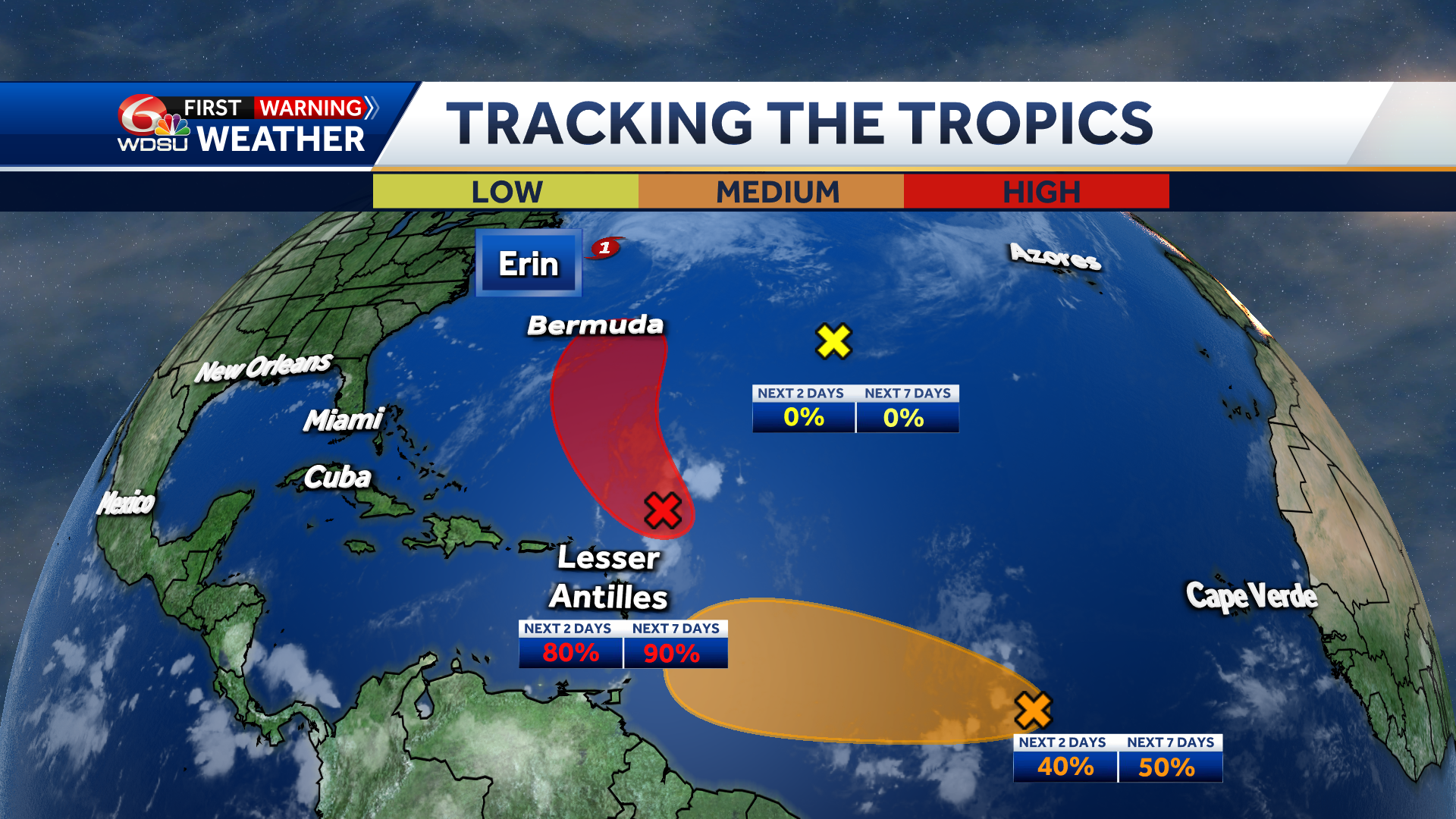
TROPICAL WAVE NEAR THE LEEWARD ISLANDS (INVEST 90L):
Showers and thunderstorms are showing some signs of organization in association with a tropical wave located about a hundred miles east-northeast of the northern Leeward Islands. Environmental conditions appear conducive for further development of this system, and a tropical depression or tropical storm is very likely to form this weekend while it moves northwestward and then northward, in between the northern Leeward Islands and Bermuda.
WHAT WE KNOW:
Chance of development over the next 2 days: Medium 40%
Chance of development over the next 3-7 days: Medium 50%
IMPACTS TO SOUTHEAST LOUISIANA:
None.
TROPICAL WAVE IN THE CENTRAL TROPICAL ATLANTIC (INVEST 99L):
Showers and thunderstorms associated with a tropical wave located about midway between Africa and the Windward Islands have become less organized overnight. While there is still some chance that a short-lived tropical depression could form during the next day or so, the system is expected to move through a less conducive environment into Saturday. The wave could reach a slightly more favorable environment again late this weekend into early next week as it moves westward at 10 to 15 mph over the central tropical Atlantic and approaches the Lesser Antilles.
WHAT WE KNOW:
Chance of development over the next 2 days: Medium 40%
Chance of development over the next 3-7 days: Medium 50%
IMPACTS TO SOUTHEAST LOUISIANA:
None at this time
CENTRAL SUBTROPICAL ATLANTIC:
A small area of low pressure located well southwest of the Azores has weakened overnight, and no development is expected while it drifts northward.
WHAT WE KNOW:
Chance of development over the next 2 days: Low 0%
Chance of development over the next 3-7 days: Low 0%
IMPACTS TO SOUTHEAST LOUISIANA:
None.
READ MORE:Three areas behind Erin could form into named systems. Here’s what you need to know


