Full outlook on TROPICAL STORM ERIN.
SYSTEM 1 – NORTHEAST GULF:
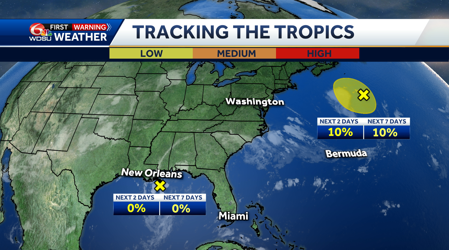
A surface trough sitting near the Louisiana coast is sparking clusters of showers and storms. While it’s not expected to organize into a tropical system before moving inland later today, it could bring heavy pockets of heavy rain and the potential for flash flooding to parts of Southeast Louisiana, the Florida Panhandle, Alabama, and Mississippi through Wednesday.
WHAT WE KNOW:
Chance of development over the next 2 days: Near 0%
Chance of development over the next 3-7 days: Near 0%
IMPACTS TO SOUTHEAST LOUISIANA:
Periods of heavy rain and localized flooding possible
SYSTEM 2 – NORTHWESTERN ATLANTIC:
A low-pressure system a few hundred miles southeast of Nova Scotia continues to produce scattered showers and storms, mainly on the southwest side.
It’s now moving north into cooler waters, which will cut off any chance for it to develop into a tropical or subtropical system.
WHAT WE KNOW:
Chance of development over the next 2 days: Low 0%
Chance of development over the next 3-7 days: Low, 0%
IMPACTS TO SOUTHEAST LOUISIANA:
None
READ MORE:Two tropical disturbances and one tropical storm being monitored


