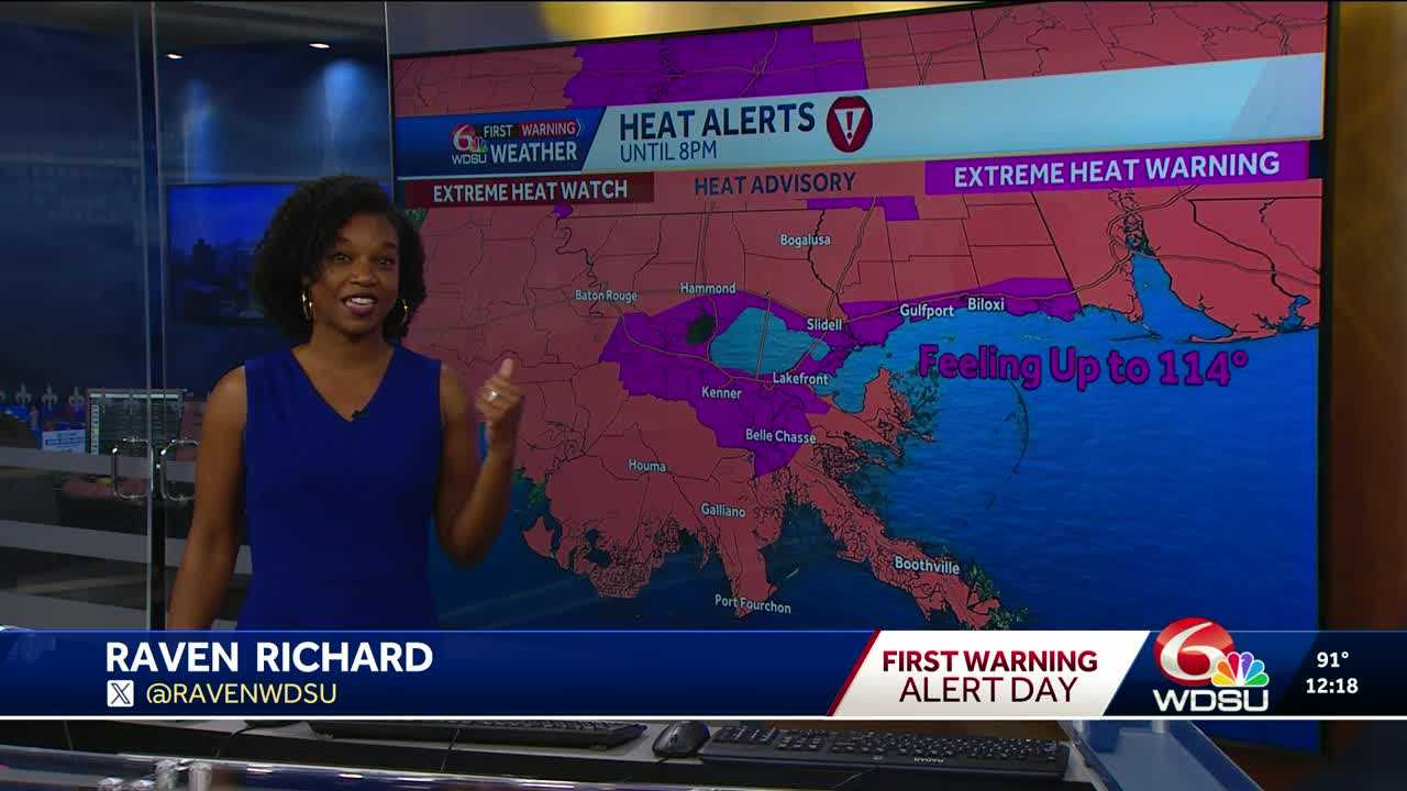
Today is a WDSU First Warning Weather Alert Day due to an EXTREME HEAT WARNING until 8 p.m. Areas not under an extreme heat warning, are under a HEAT ADVISORY as those areas could feel over 110.
Highs across Southeast Louisiana reach the mid to upper 90s but will easily feel over 110, possibly feeling up to 114.
There are little to no chances for rain today as High Pressure continues to keep us mostly quiet. There will be a small chance for a passing shower this afternoon.
Tonight is partly cloudy and muggy with lows in the 70s and 80s.
Tuesday is also expected to be another really hot day. Highs will reach the mid to upper 90s with a slightly better chance for showers. Tuesday will not be a washout. There is also the potential we could break a record for high temperatures.
For Wednesday, there is a better chance for rain to move in. There is a marginal risk for excessive rainfall. Highs will drop slightly, with highs staying just above the average high of 92 degrees.
Those rain chances pretty much stick around the finish off the week.
READ MORE:ALERT DAY: Extreme Heat Warning for parts of Southeast Louisiana, feeling up to 114


